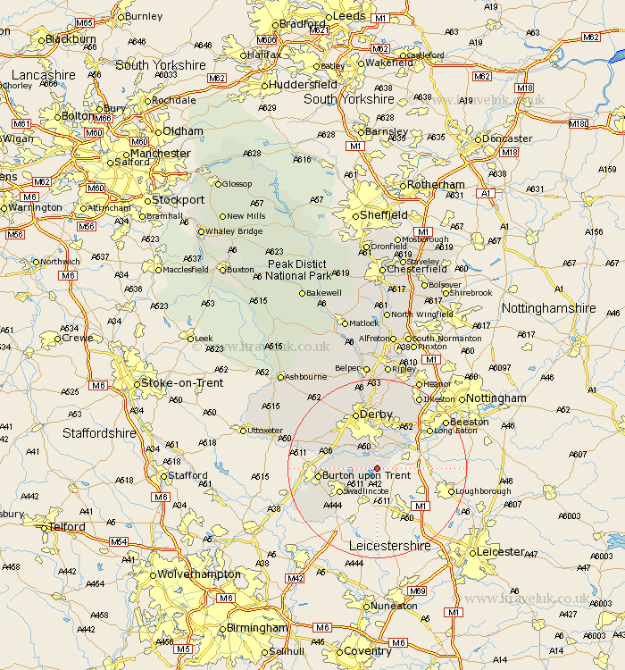
Derbyshire Map Showing Location of Melbourne
Population: 4228
Area Size (ha): 113
District: South Derbyshire
Easting: 438186 Northing: 324538
Latitude: 52.82 Longitude: -1.43
 = Melbourne
Area Size (ha): 113
District: South Derbyshire
Easting: 438186 Northing: 324538
Latitude: 52.82 Longitude: -1.43
= Melbourne
This Melbourne map below is supplied by Google. Use the tools in the top left corner to zoom into street level or zoom out for a road map, you may also need to zoom in to see Melbourne on the map. Click and drag the map to move around. If the map fails to load try and refresh your browser or zoom in or out (+ or -).
Update - it seems Google no longer allow people to use their maps for free! This Melbourne map sometimes loads and sometimes gives a error. I am working on a solution.
Closest 30 Towns or Cities to Melbourne (Population over 500)
Weston on Trent 2.9km Weston-on-Trent 2.9km Weston upon Trent 2.9km Ticknall 3.84km Shardlow 6.71km Findern 7.67km Hartshorn 7.89km Hartshorne 7.89km Repton 8.05km Willington 8.05km Woodville 9.3km Swadlincote 9.62km Borrowash 9.85km Newton Solney 10.08km Sawley 10.54km Bretby 10.75km Egginton 11.35km Burnaston 11.62km Church Gresley 11.64km Gresley 11.64km Burton on Trent 12.46km Burton-on-Trent 12.46km Burton upon Trent 12.46km Etwall 12.5km Breadsall 13.01km Risley 13.6km Linton 13.7km Derby 13.72km Dale Abbey 14.12km Overseal 14.29km