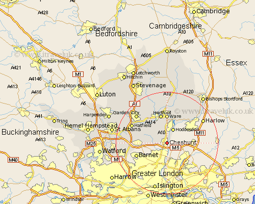
Hertfordshire Map Showing Location of Cheshunt
Population: 51102
Area Size (ha): 1201
District: Broxbourne
Easting: 535894 Northing: 202021
Latitude: 51.7 Longitude: -0.03
 = Cheshunt
Area Size (ha): 1201
District: Broxbourne
Easting: 535894 Northing: 202021
Latitude: 51.7 Longitude: -0.03
= Cheshunt
This Cheshunt map below is supplied by Google. Use the tools in the top left corner to zoom into street level or zoom out for a road map, you may also need to zoom in to see Cheshunt on the map. Click and drag the map to move around. If the map fails to load try and refresh your browser or zoom in or out (+ or -).
Update - it seems Google no longer allow people to use their maps for free! This Cheshunt map sometimes loads and sometimes gives a error. I am working on a solution.
Closest 30 Towns or Cities to Cheshunt (Population over 500)
Cuffley 5.74km Hoddesdon 6.01km Little Amwell 9.26km Great Amwell 9.33km Potters Bar 9.38km Essendon 9.77km Stanstead Abbots 9.88km Hertingfordbury 10.34km Brookmans Park 10.98km Ware 11.12km Hertford 11.35km Bishops Hatfield 11.8km Widford 13.76km Thundridge 14.87km North Mymms 15.04km Harmer Green 15.18km Hatfield 15.24km Tewin 15.26km Colney Heath 15.38km Stapleford 15.52km Welwyn Garden City 15.98km Garden City 15.98km Shenley 16.19km Borehamwood 17.02km Watton 17.3km Watton at Stone 17.3km London Colney 17.33km London Olney 17.33km Sawbridgeworth 18.1km Much Hadham 18.51km