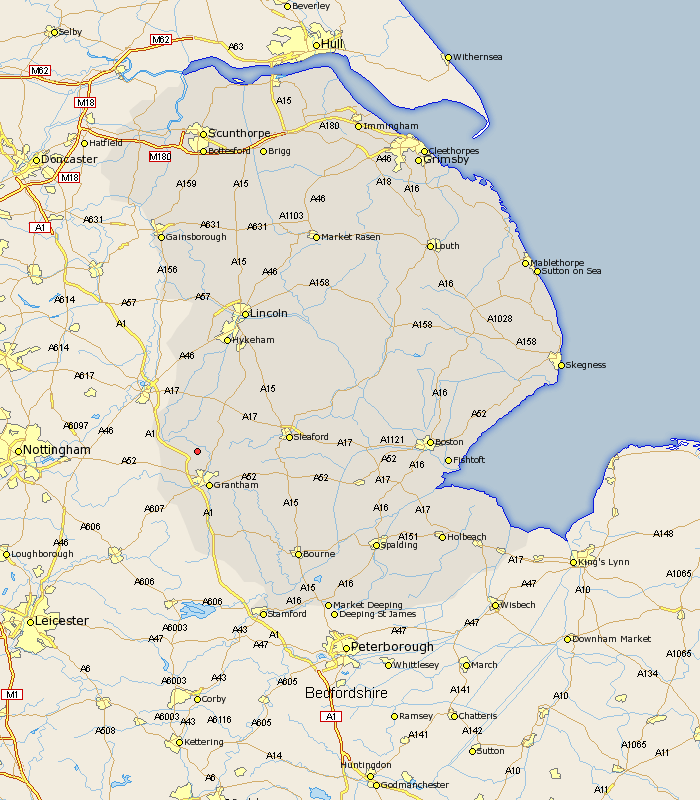
Lincolnshire Map Showing Location of Marston
Population: 417
District: South Kesteven
Easting: 489538 Northing: 341904
Latitude: 52.97 Longitude: -0.67
 = Marston
District: South Kesteven
Easting: 489538 Northing: 341904
Latitude: 52.97 Longitude: -0.67
= Marston
This Marston map below is supplied by Google. Use the tools in the top left corner to zoom into street level or zoom out for a road map, you may also need to zoom in to see Marston on the map. Click and drag the map to move around. If the map fails to load try and refresh your browser or zoom in or out (+ or -).
Update - it seems Google no longer allow people to use their maps for free! This Marston map sometimes loads and sometimes gives a error. I am working on a solution.
Closest 30 Towns or Cities to Marston (Population over 500)
Allington 5km Great Gonerby 5.56km Long Bennington 5.58km Belton 5.81km Caythorpe 7.13km Barrowby 7.5km Grantham 7.75km Claypole 8.65km Ancaster 8.93km Fulbeck 9.27km Harlaxton 11.18km Welbourn 13.58km Ropsley 13.68km Cranwell 15.3km Bassingham 16.83km Wellingore 17.3km Sleaford 17.44km Heasingham 17.63km Leasingham 17.63km Navenby 17.9km Brauncewell 18.15km Colsterworth 18.84km Ruskington 20.36km Buskington 20.36km Swinderby 20.5km Aubourn 20.65km Folkingham 21.05km Corby 21.09km Bloxholme 21.16km Bloxholm 21.16km