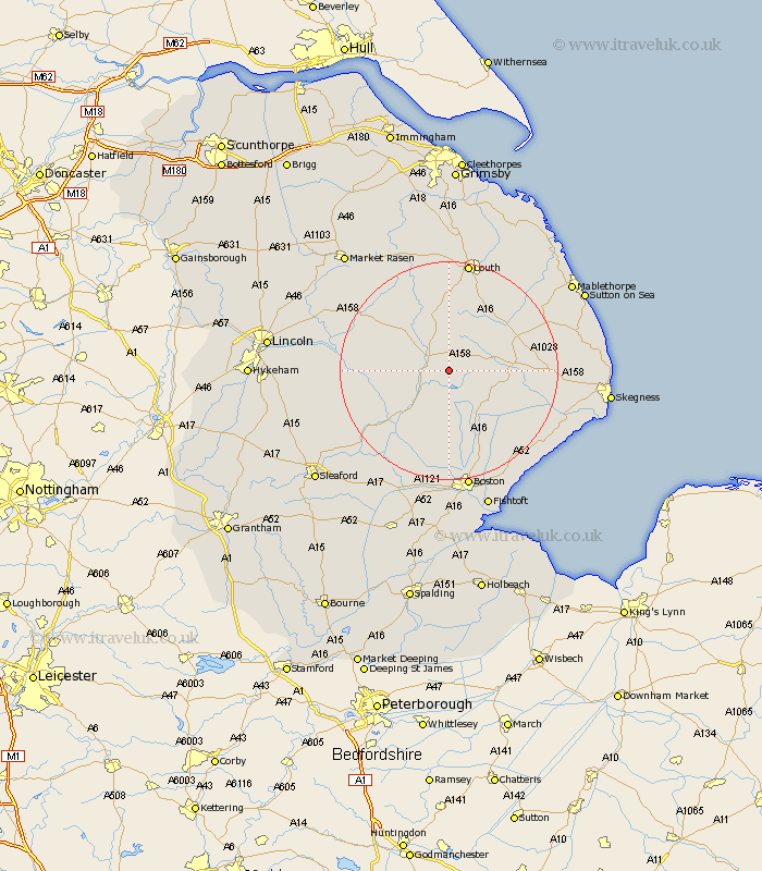
Lincolnshire Map Showing Location of Mareham
Population: 875
District: East Lindsey
Easting: 529177 Northing: 366910
Latitude: 53.18 Longitude: -0.07
 = Mareham
District: East Lindsey
Easting: 529177 Northing: 366910
Latitude: 53.18 Longitude: -0.07
= Mareham
This Mareham map below is supplied by Google. Use the tools in the top left corner to zoom into street level or zoom out for a road map, you may also need to zoom in to see Mareham on the map. Click and drag the map to move around. If the map fails to load try and refresh your browser or zoom in or out (+ or -).
Update - it seems Google no longer allow people to use their maps for free! This Mareham map sometimes loads and sometimes gives a error. I am working on a solution.
Closest 30 Towns or Cities to Mareham (Population over 500)
Banovallum 3.81km Horncastle 3.81km Coningsby 9.97km Woodhall Spa 10.66km Spilsby 11.11km Carrington 11.17km Stickney 12.43km Tattershall 12.84km Frithville 16.83km Bardney 17.06km Sibsey 17.58km Willoughby 18.15km Alford 18.22km Billinghay 18.24km Legbourne 18.4km Wragby 19.1km Martin 19.26km Louth 20.66km Wrangle 20.69km Friskney 21.13km Burgh le Marsh 21.43km Old Leake 21.61km Leake 21.61km Croft 21.83km Holton 21.98km Brothertoft 22.35km Boston 22.49km Dunston 22.53km Grimoldby 22.7km Leverton 22.71km