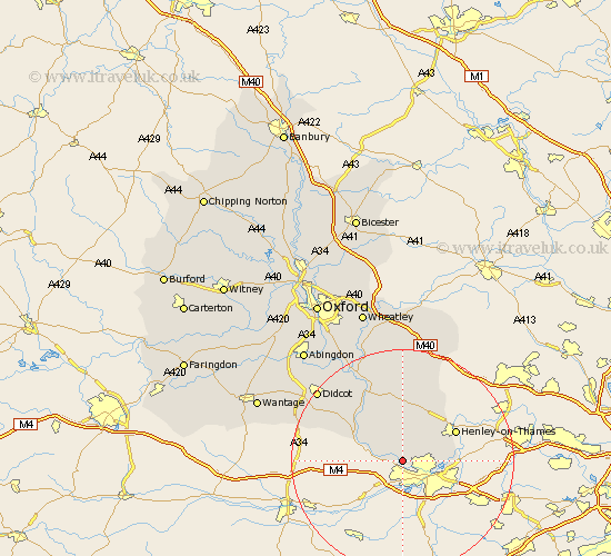
Oxfordshire Map Showing Location of Mapledurham
Population: 280
District: South Oxfordshire
Easting: 467116 Northing: 176535
Latitude: 51.48 Longitude: -1.03
 = Mapledurham
District: South Oxfordshire
Easting: 467116 Northing: 176535
Latitude: 51.48 Longitude: -1.03
= Mapledurham
This Mapledurham map below is supplied by Google. Use the tools in the top left corner to zoom into street level or zoom out for a road map, you may also need to zoom in to see Mapledurham on the map. Click and drag the map to move around. If the map fails to load try and refresh your browser or zoom in or out (+ or -).
Update - it seems Google no longer allow people to use their maps for free! This Mapledurham map sometimes loads and sometimes gives a error. I am working on a solution.
Closest 30 Towns or Cities to Mapledurham (Population over 500)
Whitchurch 3.46km Rotherfield Peppard 7.22km Goring 7.86km Shiplake 9.23km Nuffield 9.27km Bix 9.39km Moulsford 9.8km Nettlebed 9.9km Harpsden 9.95km Henley-on-Thames 10.77km Henley on Thames 10.77km Cholsey 12.29km Ewelme 13.18km Wallingford 14.7km Blewbury 15.7km Warborough 16.37km Watlington 16.84km Benson 17.65km Hagbourne 17.75km East Hagbourne 17.75km Chilton 17.77km Chalgrove 18.86km Dorchester 19.06km Drayton 19.78km Drayton St. Leonard 19.78km Drayton St Leonard 19.78km Drayton Saint Leonard 19.78km Didcot 19.82km Lewknor 20.91km Aston Rowant 21.19km