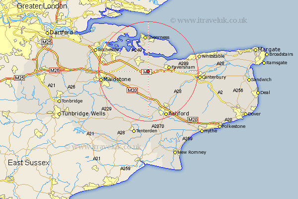
Kent Map Showing Location of Linsted
Population: 1052
District: Swale
Easting: 594007 Northing: 159388
Latitude: 51.3 Longitude: 0.78
 = Linsted
District: Swale
Easting: 594007 Northing: 159388
Latitude: 51.3 Longitude: 0.78
= Linsted
This Linsted map below is supplied by Google. Use the tools in the top left corner to zoom into street level or zoom out for a road map, you may also need to zoom in to see Linsted on the map. Click and drag the map to move around. If the map fails to load try and refresh your browser or zoom in or out (+ or -).
Update - it seems Google no longer allow people to use their maps for free! This Linsted map sometimes loads and sometimes gives a error. I am working on a solution.
Closest 30 Towns or Cities to Linsted (Population over 500)
Bapchild 2.19km Doddington 3.88km Sittingbourne 4.37km Teynham 4.37km Tunstall 4.99km Bredgar 5.79km Ospringe 5.79km Borden 6.08km Oare 7.2km Bobbing 8.03km Iwade 8.19km Faversham 8.32km Lenham 8.75km Stockbury 9.45km Newington 9.83km Selling 9.99km Harrietsham 10.17km Hollingbourne 10.81km Lower Halstow 10.99km Charing 11.18km Upchurch 11.87km Eastchurch 12.53km Queenborough 13.03km Minster 13.18km Pluckley 13.18km Egerton 13.44km Warden 13.76km Leeds 13.76km Detling 14.03km Dunkirk 14.03km