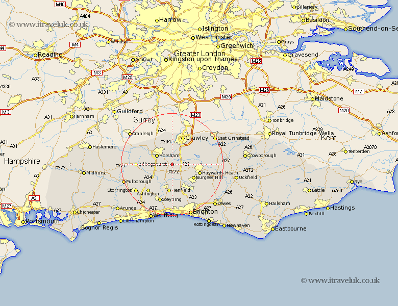
Sussex Map Showing Location of Lower Beeding
Population: 1001
District: Horsham
Easting: 522736 Northing: 125664
Latitude: 51.02 Longitude: -0.25
 = Lower Beeding
District: Horsham
Easting: 522736 Northing: 125664
Latitude: 51.02 Longitude: -0.25
= Lower Beeding
This Lower Beeding map below is supplied by Google. Use the tools in the top left corner to zoom into street level or zoom out for a road map, you may also need to zoom in to see Lower Beeding on the map. Click and drag the map to move around. If the map fails to load try and refresh your browser or zoom in or out (+ or -).
Update - it seems Google no longer allow people to use their maps for free! This Lower Beeding map sometimes loads and sometimes gives a error. I am working on a solution.
Closest 30 Towns or Cities to Lower Beeding (Population over 500)
Cowfold 3.89km Slaugham 3.95km Nuthurst 3.96km Bolney 5.1km Botney 5.1km Horsham 6.9km West Horsham 6.9km Southwater 7km West Grinstead 8.06km South Nutfield 8.16km Cuckfield 8.16km Rusper 9.34km Warnham 9.42km Itchingfield 9.51km Shipley 9.88km Burgess Hill 9.88km Balcombe 10.03km Albourne 10.38km Slinfold 11.12km Haywards Heath 11.13km Baywards Heath 11.13km Henfield 11.18km Ardingly 11.8km Crawley 11.8km Worth 12.34km Hurstpierpoint 12.56km Lindfield 12.96km Hassocks 13.8km Keymer 13.8km Turners Hill 13.8km