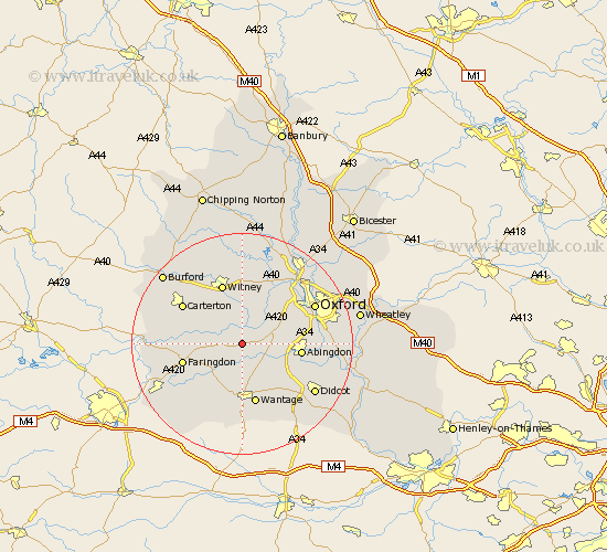
Oxfordshire Map Showing Location of Longworth
Population: 848
District: Vale of White Horse
Easting: 439172 Northing: 198485
Latitude: 51.68 Longitude: -1.43
 = Longworth
District: Vale of White Horse
Easting: 439172 Northing: 198485
Latitude: 51.68 Longitude: -1.43
= Longworth
This Longworth map below is supplied by Google. Use the tools in the top left corner to zoom into street level or zoom out for a road map, you may also need to zoom in to see Longworth on the map. Click and drag the map to move around. If the map fails to load try and refresh your browser or zoom in or out (+ or -).
Update - it seems Google no longer allow people to use their maps for free! This Longworth map sometimes loads and sometimes gives a error. I am working on a solution.
Closest 30 Towns or Cities to Longworth (Population over 500)
Kingston Bagpuize 2.17km Kingston Bagpuze 2.17km Standlake 3.89km Buckland 4.95km Stanton Harcourt 6.02km Stanford in the Vale 7.22km East Hanney 7.75km Hanney 7.75km Marcham 7.83km Cumnor 7.83km Bampton 7.83km Ducklington 8.18km Wootton 9.38km Eynsham 9.89km Ensham 9.89km Sunningwell 10.34km Clanfield 10.51km Abingdon 10.51km Abingdon-on-Thames 10.51km Abingdon on Thames 10.51km Drayton 10.75km Steventon 10.94km Faringdon 10.99km East Challow 11.18km Wantage 11.35km Witney 11.64km Childrey 11.64km North Hinksey 11.74km Milton 11.81km Cassington 12.51km