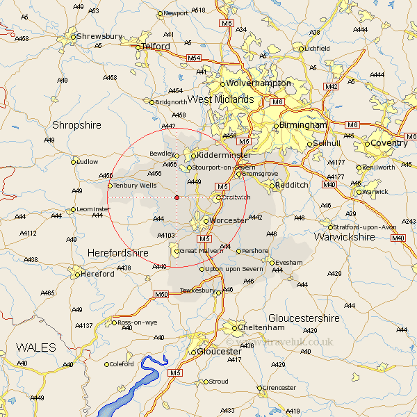
Worcestershire Map Showing Location of Little Witley
Population: 276
District: Malvern Hills
Easting: 378391 Northing: 263262
Latitude: 52.27 Longitude: -2.32
 = Little Witley
District: Malvern Hills
Easting: 378391 Northing: 263262
Latitude: 52.27 Longitude: -2.32
= Little Witley
This Little Witley map below is supplied by Google. Use the tools in the top left corner to zoom into street level or zoom out for a road map, you may also need to zoom in to see Little Witley on the map. Click and drag the map to move around. If the map fails to load try and refresh your browser or zoom in or out (+ or -).
Update - it seems Google no longer allow people to use their maps for free! This Little Witley map sometimes loads and sometimes gives a error. I am working on a solution.
Closest 30 Towns or Cities to Little Witley (Population over 500)
Great Witley 2.92km Astley 3.7km Holt 4.9km Abberley 5.03km Martley 5.04km Ombersley 5.67km Grimley 5.87km Clifton 7.05km Clifton upon Teme 7.05km Hallow 7.18km Fernhill Heath 8.77km Leigh 9.27km Rock 9.32km Hartlebury 9.33km Stourport-on-Severn 9.87km Stourport 9.87km Stourport on Severn 9.87km Worcester 10.87km Droitwich 11.34km Lindridge 11.62km Powick 12.01km Bewdley 12.97km Suckley 13.04km Stone 13.66km Kidderminster 13.73km Chaddesley Corbett 13.78km Crowle 15.51km Malvern 16.68km Great Malvern 16.68km Kempsey 16.83km