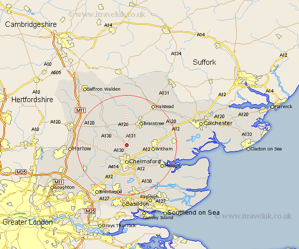
Essex Map Showing Location of Little Waltham
Population: 1278
District: Chelmsford
Easting: 571211 Northing: 214228
Latitude: 51.8 Longitude: 0.48
 = Little Waltham
District: Chelmsford
Easting: 571211 Northing: 214228
Latitude: 51.8 Longitude: 0.48
= Little Waltham
This Little Waltham map below is supplied by Google. Use the tools in the top left corner to zoom into street level or zoom out for a road map, you may also need to zoom in to see Little Waltham on the map. Click and drag the map to move around. If the map fails to load try and refresh your browser or zoom in or out (+ or -).
Update - it seems Google no longer allow people to use their maps for free! This Little Waltham map sometimes loads and sometimes gives a error. I am working on a solution.
Closest 30 Towns or Cities to Little Waltham (Population over 500)
Great Leighs 2.95km Great Waltham 2.95km Broomfield 3.88km Terling 4.58km Boreham 5.9km Black Notley 7.2km Chelmsford 7.42km Barnston 7.98km Felsted 7.98km Hatfield Peverel 8.24km Roxwell 8.85km High Easter 9.17km Little Baddow 9.38km Panfield 9.54km Cressing 9.76km Writtle 9.88km Rayne 10.11km Stebbing 10.33km Witham 10.48km Braintree 10.89km Great Baddow 11.18km Galleywood 11.18km Bradwell 11.79km Great Dunmow 12.25km Dunmow 12.25km Danbury 12.51km Wickham Bishops 12.75km Stisted 13.03km Rivenhall 13.14km Margaretting 13.76km