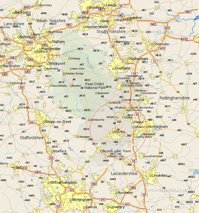
Derbyshire Map Showing Location of Little Eaton
Population: 1865
Area Size (ha): 69
District: Erewash
Easting: 436949 Northing: 339356
Latitude: 52.95 Longitude: -1.45
 = Little Eaton
Area Size (ha): 69
District: Erewash
Easting: 436949 Northing: 339356
Latitude: 52.95 Longitude: -1.45
= Little Eaton
This Little Eaton map below is supplied by Google. Use the tools in the top left corner to zoom into street level or zoom out for a road map, you may also need to zoom in to see Little Eaton on the map. Click and drag the map to move around. If the map fails to load try and refresh your browser or zoom in or out (+ or -).
Update - it seems Google no longer allow people to use their maps for free! This Little Eaton map sometimes loads and sometimes gives a error. I am working on a solution.
Closest 30 Towns or Cities to Little Eaton (Population over 500)
Little Eaton 0km Breadsall 1.86km Duffield 2.9km Quarndon 3.35km Derby 3.83km Holbrook 5.67km Kilburn 5.67km Kilbourn 5.67km Kilbourne 5.67km Smalley 5.8km West Hallam 6.7km Dale Abbey 6.95km Borrowash 7.13km Kirk Langley 8.04km Denby 8.14km Heage 9.26km Belper 9.33km Risley 9.67km Ripley 9.85km Ilkeston 10.22km Shipley Gate Station 10.52km Burnaston 10.78km Codnor 10.81km Brailsford 11.17km Ambergate Junction Station 11.34km Ambergate 11.34km Heanor 11.48km Sandiacre 11.77km Findern 12.45km Shardlow 12.99km