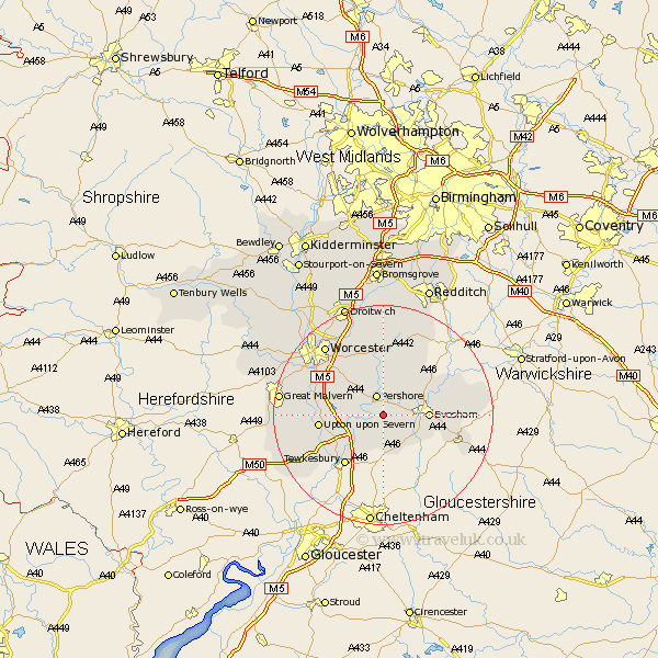
Worcestershire Map Showing Location of Little Comberton
Population: 302
District: Wychavon
Easting: 396574 Northing: 242819
Latitude: 52.08 Longitude: -2.05
 = Little Comberton
District: Wychavon
Easting: 396574 Northing: 242819
Latitude: 52.08 Longitude: -2.05
= Little Comberton
This Little Comberton map below is supplied by Google. Use the tools in the top left corner to zoom into street level or zoom out for a road map, you may also need to zoom in to see Little Comberton on the map. Click and drag the map to move around. If the map fails to load try and refresh your browser or zoom in or out (+ or -).
Update - it seems Google no longer allow people to use their maps for free! This Little Comberton map sometimes loads and sometimes gives a error. I am working on a solution.
Closest 30 Towns or Cities to Little Comberton (Population over 500)
Cropthorne 3.42km Pershore 3.88km Fladbury 4.36km Defford 4.56km Eckington 4.92km Charlton 4.92km Ashton-under-Hill 6.53km Ashton under Hill 6.53km Bredon 7.19km Beckford 7.49km Wadborough 7.77km Sedgeberrow 7.96km Evesham 7.97km Peopleton 8.16km Offenham 9.3km Bishampton 9.55km Church Lench 10.08km Harvington 10.67km Ripple 10.68km Badsey 11.39km Littleton 11.54km South Littleton 11.54km Severn Stoke 11.54km Seven Stoke 11.54km Upton 11.54km Upton-on-Severn 11.54km Upton upon Severn 11.54km Upton on Severn 11.54km Kempsey 11.66km Hanley Castle 12.53km