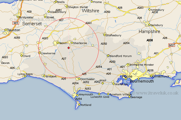
Dorset Map Showing Location of Lillington
Population: 82
District: West Dorset
Easting: 362513 Northing: 113223
Latitude: 50.92 Longitude: -2.53
 = Lillington
District: West Dorset
Easting: 362513 Northing: 113223
Latitude: 50.92 Longitude: -2.53
= Lillington
This Lillington map below is supplied by Google. Use the tools in the top left corner to zoom into street level or zoom out for a road map, you may also need to zoom in to see Lillington on the map. Click and drag the map to move around. If the map fails to load try and refresh your browser or zoom in or out (+ or -).
Update - it seems Google no longer allow people to use their maps for free! This Lillington map sometimes loads and sometimes gives a error. I am working on a solution.
Closest 30 Towns or Cities to Lillington (Population over 500)
Yetminster 2.99km Bradford Abbas 3.51km Sherbourne 4.38km Sherborne 4.38km Leigh 5.68km Buckland Newton 10.96km Stalbridge 12.25km Cerne Abbas 13.79km Marnhull 16.17km Maiden Newton 16.84km Piddletrenthide 16.94km Puddletrenthide 16.94km Sturminster Newton 17.53km Mosterton 17.97km Stour Provost 19.01km Stour 19.81km East Stour 19.81km Shillingstone 19.95km Beaminster 19.99km Child Okeford 21.03km Charminster 21.22km Netherbury 21.25km Broadwindsor 21.77km Broadwinsor 21.77km Bourton 21.77km Milton Abbas 21.82km Puddletown 22.57km Piddletown 22.57km Gillingham 22.73km Stickland Winterborne 23km