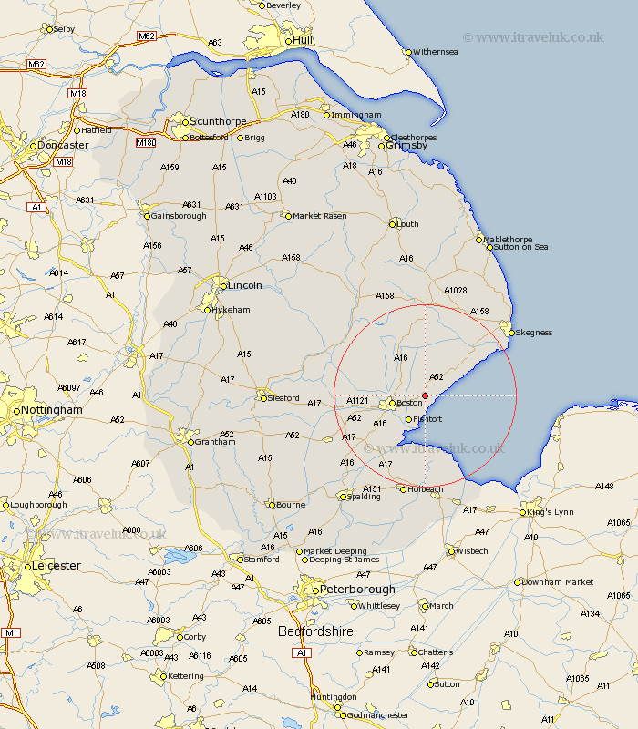
Lincolnshire Map Showing Location of Leverton
Population: 668
District: Boston
Easting: 539791 Northing: 346806
Latitude: 53 Longitude: 0.08
 = Leverton
District: Boston
Easting: 539791 Northing: 346806
Latitude: 53 Longitude: 0.08
= Leverton
This Leverton map below is supplied by Google. Use the tools in the top left corner to zoom into street level or zoom out for a road map, you may also need to zoom in to see Leverton on the map. Click and drag the map to move around. If the map fails to load try and refresh your browser or zoom in or out (+ or -).
Update - it seems Google no longer allow people to use their maps for free! This Leverton map sometimes loads and sometimes gives a error. I am working on a solution.
Closest 30 Towns or Cities to Leverton (Population over 500)
Benington 1.86km Bennington 1.86km Old Leake 2.17km Leake 2.17km Butterwick 2.17km Wrangle 4.32km Frieston 4.32km Freiston 4.32km Sibsey 5.8km Fishtoft 6.49km Boston 6.95km Frithville 8.64km Friskney 9.99km Wyberton 9.99km Stickney 10.28km Frampton 11.43km Brothertoft 12.41km Carrington 12.86km Kirton 12.87km Wainfleet All Saints 15.74km Wainfleet 15.74km Sutterton 15.76km Swineshead 17.3km Croft 18.54km Bicker 19.14km Burgh le Marsh 20.05km Spilsby 20.41km Coningsby 21.15km Tattershall 21.96km Donington 22km