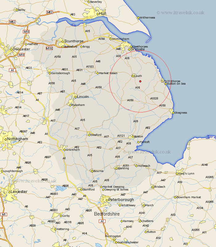
Lincolnshire Map Showing Location of Legbourne
Population: 627
District: East Lindsey
Easting: 536492 Northing: 383809
Latitude: 53.33 Longitude: 0.05
 = Legbourne
District: East Lindsey
Easting: 536492 Northing: 383809
Latitude: 53.33 Longitude: 0.05
= Legbourne
This Legbourne map below is supplied by Google. Use the tools in the top left corner to zoom into street level or zoom out for a road map, you may also need to zoom in to see Legbourne on the map. Click and drag the map to move around. If the map fails to load try and refresh your browser or zoom in or out (+ or -).
Update - it seems Google no longer allow people to use their maps for free! This Legbourne map sometimes loads and sometimes gives a error. I am working on a solution.
Closest 30 Towns or Cities to Legbourne (Population over 500)
Grimoldby 4.32km Manby 4.98km Louth 5.78km Saltfleetby Saint Clement 11.55km Saltfleetby St Clement 11.55km Saltfleetby 11.55km Saltfleetby St. Clement 11.55km Saltfleet 12.82km Alford 12.82km North Somercotes 12.95km Mablethorpe 13.28km Fulstow 13.71km North Coates 14.87km Grainthorpe 15km Sutton on Sea 15.61km Sutton-on-Sea 15.61km North Thoresby 16.25km Willoughby 16.36km Spilsby 17.01km Huttoft 17.12km Tetney 17.26km Mareham 18.4km Mareham on the Hill 18.4km Mareham-on-the-Hill 18.4km Horncastle 18.51km Banovallum 18.51km binbrook 19.06km Holton le Clay 21.81km Chapel Saint Leonards 21.97km Chapel St Leonards 21.97km