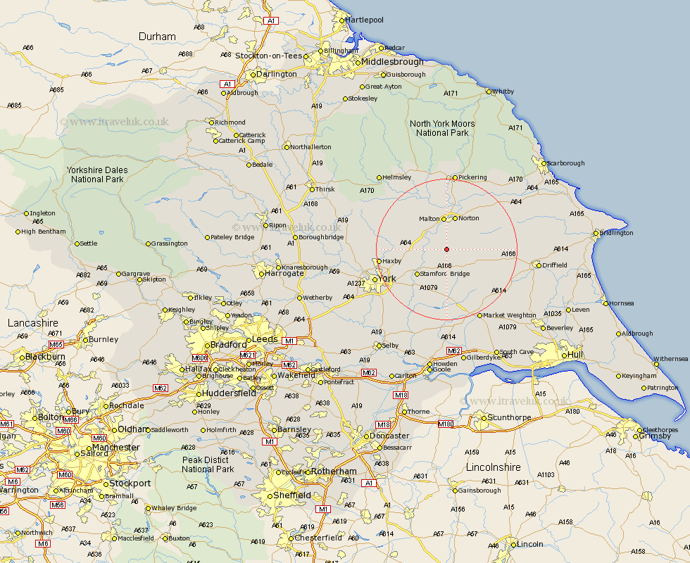
Yorkshire Map Showing Location of Leavening
Population: 363
District: Ryedale
Easting: 478555 Northing: 462246
Latitude: 54.05 Longitude: -0.8
 = Leavening
District: Ryedale
Easting: 478555 Northing: 462246
Latitude: 54.05 Longitude: -0.8
= Leavening
This Leavening map below is supplied by Google. Use the tools in the top left corner to zoom into street level or zoom out for a road map, you may also need to zoom in to see Leavening on the map. Click and drag the map to move around. If the map fails to load try and refresh your browser or zoom in or out (+ or -).
Update - it seems Google no longer allow people to use their maps for free! This Leavening map sometimes loads and sometimes gives a error. I am working on a solution.
Closest 30 Towns or Cities to Leavening (Population over 500)
Malton 9.28km Fangfoss 9.52km Norton 9.88km Stamford Bridge 10.63km Wilberfoss 12.38km Rillington 12.89km Barmby 13.02km Barmby-on-the-Moor 13.02km Barmby on the Moor 13.02km Terrington 13.16km Pocklington 13.38km Slingsby 13.47km Sheriff Hutton 13.57km Strensall 15.23km Wetwang 16.22km Sutton upon Derwent 16.67km Sutton 16.67km Earswick 17.25km Huntington 17.25km Haxby 17.8km Wigginton 17.8km Melbourne 18.82km Heslington 18.87km New Earswick 18.93km Yedingham 20.52km York 20.7km Thornton-le-Dale 21.09km Thornton Dale 21.09km Stillington 21.39km Wheldrake 21.5km