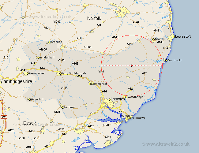
Suffolk Map Showing Location of Laxfield
Population: 872
District: Mid Suffolk
Easting: 629520 Northing: 272256
Latitude: 52.3 Longitude: 1.37
 = Laxfield
District: Mid Suffolk
Easting: 629520 Northing: 272256
Latitude: 52.3 Longitude: 1.37
= Laxfield
This Laxfield map below is supplied by Google. Use the tools in the top left corner to zoom into street level or zoom out for a road map, you may also need to zoom in to see Laxfield on the map. Click and drag the map to move around. If the map fails to load try and refresh your browser or zoom in or out (+ or -).
Update - it seems Google no longer allow people to use their maps for free! This Laxfield map sometimes loads and sometimes gives a error. I am working on a solution.
Closest 30 Towns or Cities to Laxfield (Population over 500)
Dennington 5.85km Cookley 5.96km Stradbroke 7.05km Fressingfield 7.17km Worlingworth 8.76km Framlingham 9.54km Halesworth 10.63km Holton 10.85km Yoxford 10.85km Wenhaston 12.6km Hoxne 12.62km Saxmundham 12.97km Eye 14.85km Debenham 15.54km Snape 15.84km Thorndon 15.98km Wickham Market 16.68km Leiston 17.58km Bungay 17.61km Wangford 17.88km Otley 18.99km Tunstall 19.39km Ufford 20.41km Rendlesham 20.66km Reydon 21.13km Mendlesham 21.16km Gislingham 21.53km Southwold 21.84km Wortham 22.23km Worlingham 22.24km