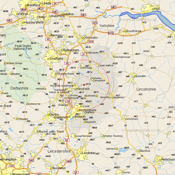
Nottinghamshire Map Showing Location of Clipstone
Population: 3469
District: Newark and Sherwood
Easting: 460159 Northing: 363697
Latitude: 53.17 Longitude: -1.1
 = Clipstone
District: Newark and Sherwood
Easting: 460159 Northing: 363697
Latitude: 53.17 Longitude: -1.1
= Clipstone
This Clipstone map below is supplied by Google. Use the tools in the top left corner to zoom into street level or zoom out for a road map, you may also need to zoom in to see Clipstone on the map. Click and drag the map to move around. If the map fails to load try and refresh your browser or zoom in or out (+ or -).
Update - it seems Google no longer allow people to use their maps for free! This Clipstone map sometimes loads and sometimes gives a error. I am working on a solution.
Closest 30 Towns or Cities to Clipstone (Population over 500)
Edwinstowe 2.89km Warsop 4.98km Rainworth 5.67km Bilsthorpe 5.79km Mansfield Woodhouse 6.67km Mansfield 7.63km Ollerton 7.86km Boughton 8.01km Farnsfield 8.65km Blidworth 9.54km Pleasley 10km Walesby 10.73km Sutton in Ashfield 12.43km Oxton 13.17km Southwell 13.45km Newstead 13.57km Huthwaite 13.84km Hucknall under Huthwaite 13.84km Hucknall 13.84km Hucknall-under-Huthwaite 13.84km Papplewick 14.12km Elkesley 14.23km Elksley 14.23km Kirkby 14.48km Kirkby in Ashfield 14.48km Claverton 14.88km Calverton 14.88km Worksop 14.99km Tuxford 15.47km Annesley 16.39km