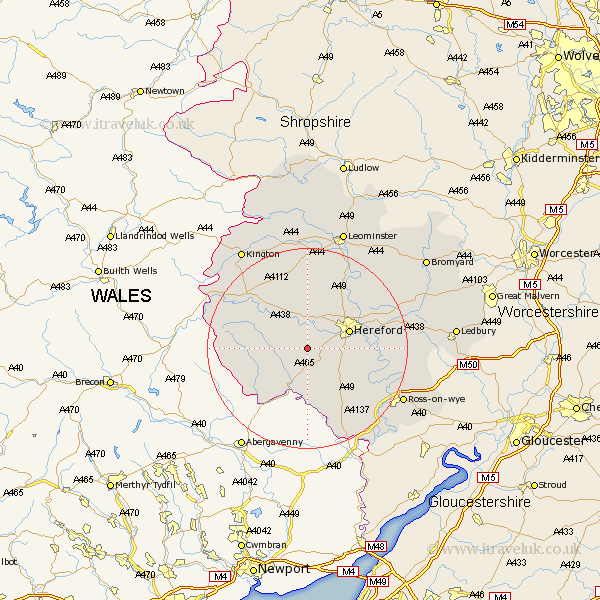
Herefordshire Map Showing Location of Kingstone
Population: 1299
Easting: 342818 Northing: 235738
Latitude: 52.02 Longitude: -2.83
 = Kingstone
Easting: 342818 Northing: 235738
Latitude: 52.02 Longitude: -2.83
= Kingstone
This Kingstone map below is supplied by Google. Use the tools in the top left corner to zoom into street level or zoom out for a road map, you may also need to zoom in to see Kingstone on the map. Click and drag the map to move around. If the map fails to load try and refresh your browser or zoom in or out (+ or -).
Update - it seems Google no longer allow people to use their maps for free! This Kingstone map sometimes loads and sometimes gives a error. I am working on a solution.
Closest 30 Towns or Cities to Kingstone (Population over 500)
Madley 2.17km Allensmore 3.42km Much Dewchurch 6.81km Ewyas Harold 8.17km Bullingham 8.19km Peterchurch 8.19km Hereford 8.8km Credenhill 9.54km Much Birch 9.73km Burghill 10.32km Moreton 11.51km Moreton on Lugg 11.51km Moreton-on-Lugg 11.51km Lugwardine 13.72km Sutton 13.82km Wellington 14.16km Mordiford 14.17km Broad Oak 15.89km Fownhope 16.08km Withington 16.52km Weobley 16.83km Eardisley 17.26km Almeley 18.02km Bodenham 18.02km Dilwyn 18.66km Clifford 20.45km Ross on Wye 21.39km Ross-on-wye 21.39km Ross 21.39km Walford 21.81km