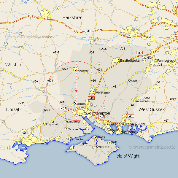
Hampshire Map Showing Location of Kings Somborne
Population: 1573
District: Test Valley
Easting: 436198 Northing: 129893
Latitude: 51.07 Longitude: -1.48
 = Kings Somborne
District: Test Valley
Easting: 436198 Northing: 129893
Latitude: 51.07 Longitude: -1.48
= Kings Somborne
This Kings Somborne map below is supplied by Google. Use the tools in the top left corner to zoom into street level or zoom out for a road map, you may also need to zoom in to see Kings Somborne on the map. Click and drag the map to move around. If the map fails to load try and refresh your browser or zoom in or out (+ or -).
Update - it seems Google no longer allow people to use their maps for free! This Kings Somborne map sometimes loads and sometimes gives a error. I am working on a solution.
Closest 30 Towns or Cities to Kings Somborne (Population over 500)
Stockbridge 3.7km Michelmersh 3.89km Michlemersh 3.89km Broughton 5.01km Sparsholt 6.99km Nether Wallop 8.05km Hursley 8.05km Romsey 9.35km Chilbolton 9.9km Over Wallop 11.01km Goodworth Clatford 11.12km Clatford 11.12km Lower Clatford 11.12km Sherfield English 11.61km Winchester 11.7km Compton 11.87km Otterbourne 11.91km Twyford 12.91km Kings Worthy 12.94km Upper Clatford 12.97km West Wellow 13.14km Abbots Ann 13.17km Abbotts Ann 13.17km Barton Stacey 13.78km Chilworth 13.79km Longparish 14.21km Eastleigh 14.51km Andover 14.82km Wonston 14.87km Bishopstoke 15.29km