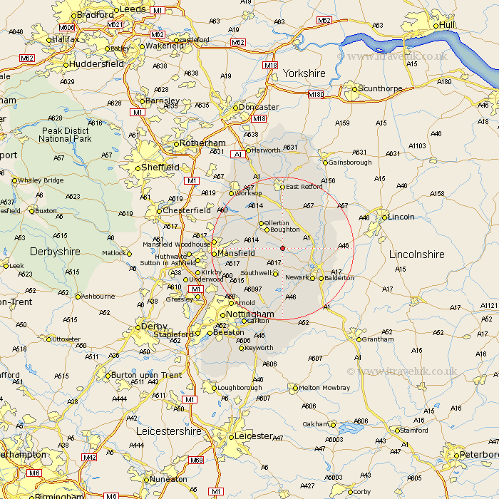
Nottinghamshire Map Showing Location of Kersall
Population: 46
District: Newark and Sherwood
Easting: 471328 Northing: 361992
Latitude: 53.15 Longitude: -0.93
 = Kersall
District: Newark and Sherwood
Easting: 471328 Northing: 361992
Latitude: 53.15 Longitude: -0.93
= Kersall
This Kersall map below is supplied by Google. Use the tools in the top left corner to zoom into street level or zoom out for a road map, you may also need to zoom in to see Kersall on the map. Click and drag the map to move around. If the map fails to load try and refresh your browser or zoom in or out (+ or -).
Update - it seems Google no longer allow people to use their maps for free! This Kersall map sometimes loads and sometimes gives a error. I am working on a solution.
Closest 30 Towns or Cities to Kersall (Population over 500)
Boughton 6.85km Bilsthorpe 6.92km Southwell 8.02km Tuxford 8.13km Muskham 8.62km North Muskham 8.62km Farnsfield 8.69km Ollerton 9.27km Edwinstowe 9.63km Walesby 9.84km Clipstone 11.27km Fiskerton 11.34km Fiskerton Ferry 11.34km Winthorpe 11.45km East Markham 11.61km Markham 11.61km Newark upon Trent 12.1km Newark 12.1km Newark on Trent 12.1km Newark-on-Trent 12.1km North Collingham 12.23km Collingham 12.23km Farndon 12.43km Rainworth 12.78km Bleasby 12.98km Elksley 13.16km Elkesley 13.16km Balderton 13.64km Oxton 14.24km Coddington 14.31km