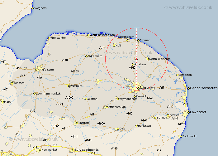
Norfolk Map Showing Location of Ingworth
Population: 94
District: North Norfolk
Easting: 621223 Northing: 329440
Latitude: 52.82 Longitude: 1.28
 = Ingworth
District: North Norfolk
Easting: 621223 Northing: 329440
Latitude: 52.82 Longitude: 1.28
= Ingworth
This Ingworth map below is supplied by Google. Use the tools in the top left corner to zoom into street level or zoom out for a road map, you may also need to zoom in to see Ingworth on the map. Click and drag the map to move around. If the map fails to load try and refresh your browser or zoom in or out (+ or -).
Update - it seems Google no longer allow people to use their maps for free! This Ingworth map sometimes loads and sometimes gives a error. I am working on a solution.
Closest 30 Towns or Cities to Ingworth (Population over 500)
Erpingham 2.9km Felmingham 3.84km Aylsham 4.34km Marsham 5.99km North Walsham 6.72km Roughton 7.49km Hevingham 7.5km Little Hautbois 8.14km Lamas Little Hautbois 8.14km Lammas 8.14km Trunch 8.67km Cawston 9.61km Northrepps 9.85km Corpusty 10.08km Mundesley 10.54km Mundersley 10.54km Worstead 10.75km Coltishall 10.83km Hainford 11.18km Haynford 11.18km Overstrand 11.99km Horstead 11.99km Smallburgh 12.51km Bacton 12.86km Cromer 13.01km West Runton 13.16km Runton 13.16km Reepham 13.44km Sheringham 14.12km Witchingham 14.55km