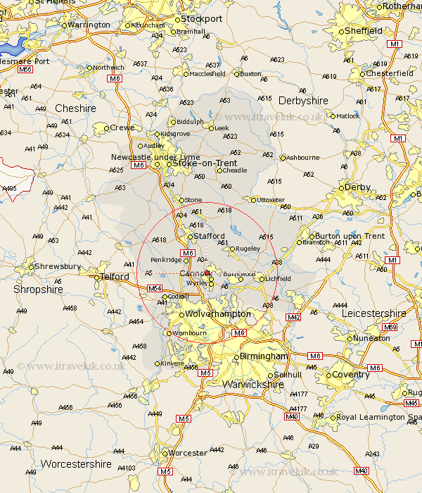
Staffordshire Map Showing Location of Huntington
Population: 3940
District: South Staffordshire
Easting: 397747 Northing: 311408
Latitude: 52.7 Longitude: -2.03
 = Huntington
District: South Staffordshire
Easting: 397747 Northing: 311408
Latitude: 52.7 Longitude: -2.03
= Huntington
This Huntington map below is supplied by Google. Use the tools in the top left corner to zoom into street level or zoom out for a road map, you may also need to zoom in to see Huntington on the map. Click and drag the map to move around. If the map fails to load try and refresh your browser or zoom in or out (+ or -).
Update - it seems Google no longer allow people to use their maps for free! This Huntington map sometimes loads and sometimes gives a error. I am working on a solution.
Closest 30 Towns or Cities to Huntington (Population over 500)
Cannock 2.17km Hednesford 2.25km Wyrley 3.59km Great Wyrley 3.59km Norton Canes 4.86km Shareshill 5.01km Penkridge 6.72km Bednall 7.75km Brewood 9.18km Burntwood 9.18km Colwich 9.85km Rugeley 10.02km Brownhills 10.02km Longdon 10.28km Armitage 10.76km Colton 10.8km Pelsall 10.83km Walsall 11.35km Wallsall 11.35km Hammerwich 11.54km Stafford 11.99km Rushall 12.46km Wheaton Aston 12.49km Codsall 13.47km Aldridge 13.62km Haughton 14.55km Church Eaton 14.57km Wolverhampton 14.63km Lichfield 14.72km Weston upon Trent 14.87km