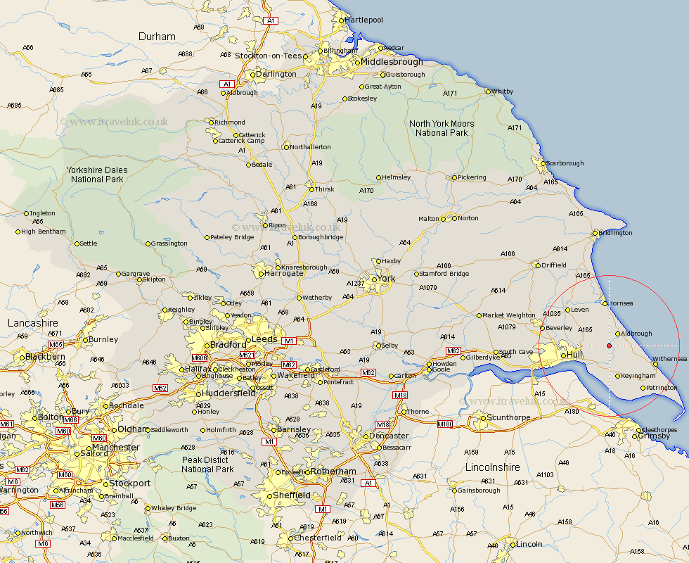
Yorkshire Map Showing Location of Humbleton
Population: 209
Easting: 521877 Northing: 433497
Latitude: 53.78 Longitude: -0.15
 = Humbleton
Easting: 521877 Northing: 433497
Latitude: 53.78 Longitude: -0.15
= Humbleton
This Humbleton map below is supplied by Google. Use the tools in the top left corner to zoom into street level or zoom out for a road map, you may also need to zoom in to see Humbleton on the map. Click and drag the map to move around. If the map fails to load try and refresh your browser or zoom in or out (+ or -).
Update - it seems Google no longer allow people to use their maps for free! This Humbleton map sometimes loads and sometimes gives a error. I am working on a solution.
Closest 30 Towns or Cities to Humbleton (Population over 500)
Sproatley 2.19km Burton Pidsea 3.77km Preston 3.77km Aldbrough 4.31km Burstwick 5.67km Hedon 5.98km Thorngumbold 7.49km Thorngumbald 7.49km Roos 7.54km Skirlaugh Station 7.54km Walkington 7.54km Paull 9.21km Keyingham 9.52km Ottringham 10.25km Sutton 10.95km Sutton on Hull 10.95km Sutton-on-Hull 10.95km Hull 12.41km Hornsea 13.02km Wawne 13.27km Withernsea 13.27km Kingston upon Hull 14.15km Cottingham 15.33km Leven 15.6km Patrington 15.65km Woodmansey 15.77km Brandsburton 17.8km Brandesburton 17.8km Tickton 17.9km Beverley 18.37km