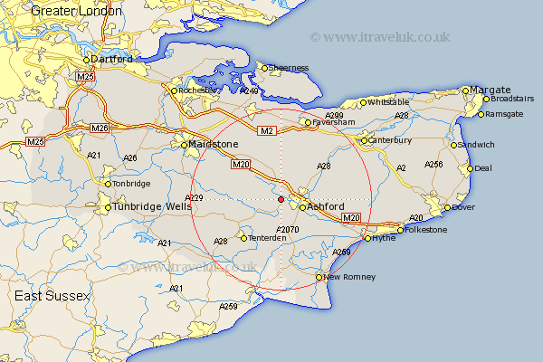
Kent Map Showing Location of Hothfield
Population: 880
District: Ashford
Easting: 596970 Northing: 142801
Latitude: 51.15 Longitude: 0.82
 = Hothfield
District: Ashford
Easting: 596970 Northing: 142801
Latitude: 51.15 Longitude: 0.82
= Hothfield
This Hothfield map below is supplied by Google. Use the tools in the top left corner to zoom into street level or zoom out for a road map, you may also need to zoom in to see Hothfield on the map. Click and drag the map to move around. If the map fails to load try and refresh your browser or zoom in or out (+ or -).
Update - it seems Google no longer allow people to use their maps for free! This Hothfield map sometimes loads and sometimes gives a error. I am working on a solution.
Closest 30 Towns or Cities to Hothfield (Population over 500)
Hothfield 0km Kennington 4.65km Ashford 5.01km Bethersden 5.09km Shadoxhurst 5.56km Charing 5.68km Pluckley 5.94km Kingsnorth 6.03km Egerton 6.89km Hinxhill 8.35km Wye 8.94km Smarden 9.49km Orlestone 9.55km Mersham 9.86km Woodchurch 9.9km High Halden 10.18km Smeeth 11.1km Ham Street 11.36km Lenham 11.59km Aldington 11.9km Rockinge 12.05km Ruckinge 12.05km Tenterden 12.39km Ulcombe 12.88km Brabourne 12.92km Harrietsham 13.12km Doddington 13.44km Biddenden 13.95km Headcorn 13.95km Sellinge 13.95km