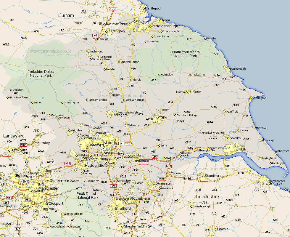
Yorkshire Map Showing Location of Conisborough
Population: 15752
Area Size (ha): 358
District: Doncaster
Easting: 451995 Northing: 396972
Latitude: 53.47 Longitude: -1.22
 = Conisborough
Area Size (ha): 358
District: Doncaster
Easting: 451995 Northing: 396972
Latitude: 53.47 Longitude: -1.22
= Conisborough
This Conisborough map below is supplied by Google. Use the tools in the top left corner to zoom into street level or zoom out for a road map, you may also need to zoom in to see Conisborough on the map. Click and drag the map to move around. If the map fails to load try and refresh your browser or zoom in or out (+ or -).
Update - it seems Google no longer allow people to use their maps for free! This Conisborough map sometimes loads and sometimes gives a error. I am working on a solution.
Closest 30 Towns or Cities to Conisborough (Population over 500)
Mexborough 3.79km Sprotbrough 3.87km Sprotboro 3.87km Braithwell 3.87km Warmsworth 4.31km Wadsworth 4.41km Wadworth 4.41km Maltby 5.66km Thrybergh 5.82km Bramley 6.47km Swinton 6.87km Wickersley 7.1km Rawmarsh 7.94km Bentley 8.63km Tickhill 8.64km Dearne 9.23km Wath upon Dearne 9.57km Wath-on-Dearne 9.57km Wath 9.57km Wath on Dearne 9.57km Rotherdam 9.58km Rotherham 9.58km Brodsworth 9.84km Brampton en le Morthern 9.84km Brampton en le Morthen 9.84km Brampton 9.84km Rossington 9.93km Doncaster 9.93km Whiston 10.71km Bessacarr 10.76km