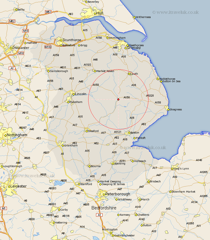
Lincolnshire Map Showing Location of Banovallum
Population: 4891
Area Size (ha): 198
District: East Lindsey
Easting: 525787 Northing: 368678
Latitude: 53.2 Longitude: -0.12
 = Banovallum
Area Size (ha): 198
District: East Lindsey
Easting: 525787 Northing: 368678
Latitude: 53.2 Longitude: -0.12
= Banovallum
This Banovallum map below is supplied by Google. Use the tools in the top left corner to zoom into street level or zoom out for a road map, you may also need to zoom in to see Banovallum on the map. Click and drag the map to move around. If the map fails to load try and refresh your browser or zoom in or out (+ or -).
Update - it seems Google no longer allow people to use their maps for free! This Banovallum map sometimes loads and sometimes gives a error. I am working on a solution.
Closest 30 Towns or Cities to Banovallum (Population over 500)
Horncastle 0km Banovallum 0km Mareham on the Hill 3.81km Mareham-on-the-Hill 3.81km Mareham 3.81km Woodhall Spa 8.68km Coningsby 9.84km Tattershall 12.43km Bardney 13.45km Carrington 13.72km Spilsby 14.55km Wragby 15.32km Stickney 15.73km Billinghay 17.09km Martin 17.16km Holton 18.21km Legbourne 18.51km Frithville 19.35km Dunston 19.68km Louth 19.69km Potter Hanworth 20.07km Metheringham 20.29km Nocton 20.33km Sibsey 20.56km Alford 20.73km Cherry Willingham 20.99km Digby 21.13km Willoughby 21.17km Fiskerton 21.41km Reepham 21.41km