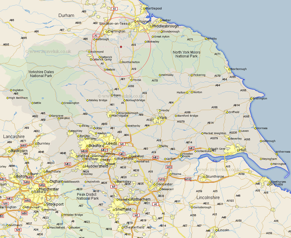
Yorkshire Map Showing Location of Hornby
Population: 206
District: Hambleton
Easting: 436754 Northing: 504372
Latitude: 54.43 Longitude: -1.43
 = Hornby
District: Hambleton
Easting: 436754 Northing: 504372
Latitude: 54.43 Longitude: -1.43
= Hornby
This Hornby map below is supplied by Google. Use the tools in the top left corner to zoom into street level or zoom out for a road map, you may also need to zoom in to see Hornby on the map. Click and drag the map to move around. If the map fails to load try and refresh your browser or zoom in or out (+ or -).
Update - it seems Google no longer allow people to use their maps for free! This Hornby map sometimes loads and sometimes gives a error. I am working on a solution.
Closest 30 Towns or Cities to Hornby (Population over 500)
East Cowton 6.73km Cowton 6.73km North Cowton 8.41km Brompton 9.33km Northallerton 11.12km Osmotherley 11.37km Middleton upon Leven 11.4km Middleton 11.4km Whorlton 12km Scorton 12.14km Middleton Tyas 14.13km Seamer 14.49km Barton 14.49km Catterick 14.92km Stokesley 15.53km Melsonby 17.09km Great Broughton 17.34km Gilling 18.33km Crakehall 18.99km Bedale 19.31km Richmond 19.76km Great Ayton 20.76km Ingleby 21.56km Middlesbrough 23.55km Middlesborough 23.55km Middlebrough 23.55km South Bank on Tees 23.55km South Bank-on-Tees 23.55km South Bank in Normanby 23.55km South Bank 23.55km