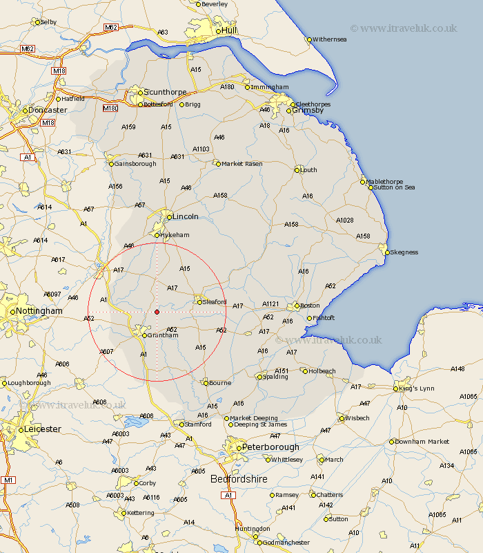
Lincolnshire Map Showing Location of Honington
Population: 133
District: South Kesteven
Easting: 495134 Northing: 342011
Latitude: 52.97 Longitude: -0.58
 = Honington
District: South Kesteven
Easting: 495134 Northing: 342011
Latitude: 52.97 Longitude: -0.58
= Honington
This Honington map below is supplied by Google. Use the tools in the top left corner to zoom into street level or zoom out for a road map, you may also need to zoom in to see Honington on the map. Click and drag the map to move around. If the map fails to load try and refresh your browser or zoom in or out (+ or -).
Update - it seems Google no longer allow people to use their maps for free! This Honington map sometimes loads and sometimes gives a error. I am working on a solution.
Closest 30 Towns or Cities to Honington (Population over 500)
Ancaster 3.35km Belton 3.88km Caythorpe 5.67km Fulbeck 7.41km Great Gonerby 7.88km Grantham 8.14km Allington 9.67km Barrowby 10km Ropsley 10.29km Cranwell 10.76km Long Bennington 11.16km Welbourn 11.34km Sleaford 11.98km Heasingham 12.46km Leasingham 12.46km Claypole 12.47km Harlaxton 12.98km Brauncewell 13.66km Wellingore 15.19km Buskington 15.3km Ruskington 15.3km Navenby 15.48km Folkingham 16.57km Bassingham 17.01km Bloxholm 17.1km Bloxholme 17.1km Colsterworth 18.67km Corby 19.07km Billingborough 19.15km Scopwick 19.23km