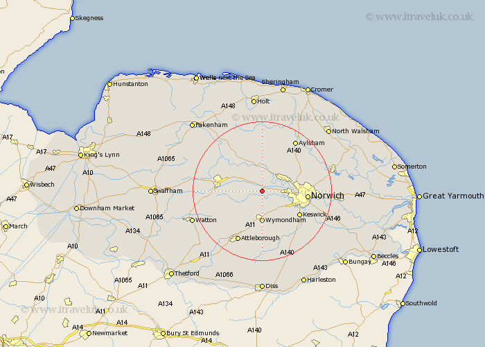
Norfolk Map Showing Location of Honingham
Population: 342
District: Broadland
Easting: 610800 Northing: 310405
Latitude: 52.65 Longitude: 1.12
 = Honingham
District: Broadland
Easting: 610800 Northing: 310405
Latitude: 52.65 Longitude: 1.12
= Honingham
This Honingham map below is supplied by Google. Use the tools in the top left corner to zoom into street level or zoom out for a road map, you may also need to zoom in to see Honingham on the map. Click and drag the map to move around. If the map fails to load try and refresh your browser or zoom in or out (+ or -).
Update - it seems Google no longer allow people to use their maps for free! This Honingham map sometimes loads and sometimes gives a error. I am working on a solution.
Closest 30 Towns or Cities to Honingham (Population over 500)
Hockering 3.85km Taverham 4.86km Mattishall 5.62km Costessey 6.75km Drayton 7km Hethersett 7.15km Lyng 8.15km Hellesdon 9.19km Wymondham 9.26km Witchingham 9.26km Horsford 9.72km Yaxham 10.12km Cringleford 10.58km Bawdeswell 10.83km Reepham 11.12km Hingham 11.66km Horsham Saint Faith 11.83km Horsham St. Faith 11.83km Horsham St Faith 11.83km Horsham 11.83km Norwich 12.51km Dereham 12.91km East Dereham 12.91km Swardeston 12.92km Cawston 13.41km Mulbarton 13.63km Ashwellthorpe 13.74km Hainford 14.41km Haynford 14.41km North Elmham 14.56km