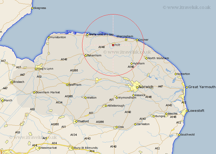
Norfolk Map Showing Location of Holt
Population: 3380
Area Size (ha): 136
District: North Norfolk
Easting: 607354 Northing: 338105
Latitude: 52.9 Longitude: 1.08
 = Holt
Area Size (ha): 136
District: North Norfolk
Easting: 607354 Northing: 338105
Latitude: 52.9 Longitude: 1.08
= Holt
This Holt map below is supplied by Google. Use the tools in the top left corner to zoom into street level or zoom out for a road map, you may also need to zoom in to see Holt on the map. Click and drag the map to move around. If the map fails to load try and refresh your browser or zoom in or out (+ or -).
Update - it seems Google no longer allow people to use their maps for free! This Holt map sometimes loads and sometimes gives a error. I am working on a solution.
Closest 30 Towns or Cities to Holt (Population over 500)
Briston 5.67km Weybourne 5.8km Melton Constable 6.49km Mellon Constable 6.49km Sheringham 8.65km Blakeney 9.28km Corpusty 9.85km Hindolveston 10.29km Runton 11.77km West Runton 11.77km Erpingham 13.42km Little Snoring 13.5km Little Walsingham 13.55km Walsingham 13.55km Foulsham 13.73km Foulham 13.73km Ryburgh 14.53km Great Ryburgh 14.53km Roughton 14.65km Cromer 14.99km Cawston 15.84km Northrepps 16.77km Reepham 16.83km Aylsham 17.14km Wells on Sea 17.31km Wells-on-Sea 17.31km Wells 17.31km Wells-next-the-Sea 17.31km Wells next the Sea 17.31km Overstrand 17.98km