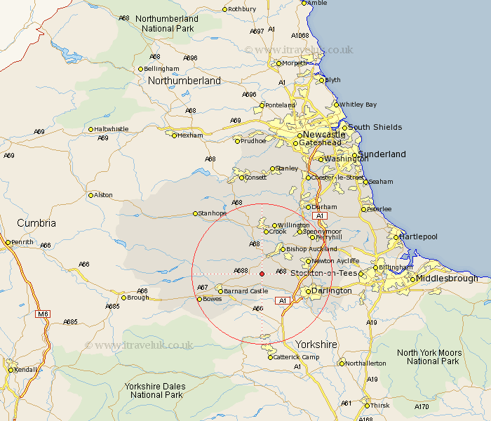
Durham Map Showing Location of Hilton
Population: 43
District: Teesdale
Easting: 416155 Northing: 520942
Latitude: 54.58 Longitude: -1.75
 = Hilton
District: Teesdale
Easting: 416155 Northing: 520942
Latitude: 54.58 Longitude: -1.75
= Hilton
This Hilton map below is supplied by Google. Use the tools in the top left corner to zoom into street level or zoom out for a road map, you may also need to zoom in to see Hilton on the map. Click and drag the map to move around. If the map fails to load try and refresh your browser or zoom in or out (+ or -).
Update - it seems Google no longer allow people to use their maps for free! This Hilton map sometimes loads and sometimes gives a error. I am working on a solution.
Closest 30 Towns or Cities to Hilton (Population over 500)
Staindrop 3.71km Gainford 3.86km Evenwood 3.87km Cockfield 4.91km West Auckland 5.66km High Etherley 7.42km Etherley 7.42km Shildon 8.51km Bishop Auckland 9.15km Coundon 11.29km Startforth 12.1km Barnard Castle 12.1km Newton Aycliffe 12.38km Crook 13.02km Darlington 13.06km Cotherstone 15.15km Willington 15.18km Spennymoor 16.11km Ferryhill 17.01km Wolsingham 17.13km Tow Law 17.22km Hurworth 18.72km Cornforth 19.84km West Cornforth 19.84km Brandon 20.42km Bishop Middleham 20.45km Stillington 20.49km Sedgefield 21.7km Middleton in Teesdale 21.79km Coxhoe 21.88km