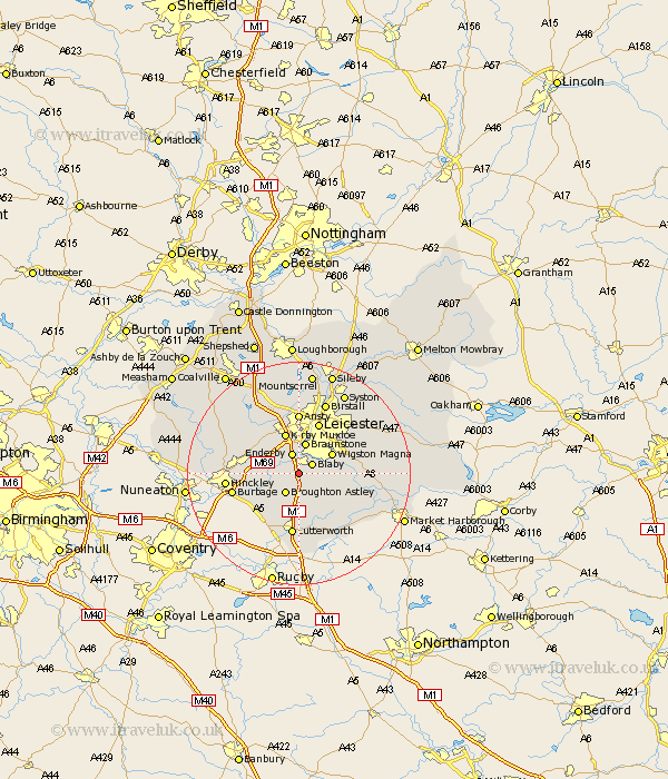
Leicestershire Map Showing Location of Cosby
Population: 3323
Area Size (ha): 83
District: Blaby
Easting: 455369 Northing: 295037
Latitude: 52.55 Longitude: -1.18
 = Cosby
Area Size (ha): 83
District: Blaby
Easting: 455369 Northing: 295037
Latitude: 52.55 Longitude: -1.18
= Cosby
This Cosby map below is supplied by Google. Use the tools in the top left corner to zoom into street level or zoom out for a road map, you may also need to zoom in to see Cosby on the map. Click and drag the map to move around. If the map fails to load try and refresh your browser or zoom in or out (+ or -).
Update - it seems Google no longer allow people to use their maps for free! This Cosby map sometimes loads and sometimes gives a error. I am working on a solution.
Closest 30 Towns or Cities to Cosby (Population over 500)
Whetstone 1.86km Narborough 2.17km Blaby 2.92km Countesthorpe 3.38km Croft 3.38km Enderby 3.87km Broughton Astley 4.34km Glen Parva 4.87km Glen Parka 4.87km Braunstone 5.67km Stoney Stanton 5.93km Wigston Magna 6.74km Wigston 6.74km Sapcote 6.75km Oadby 7.71km Sharnford 7.71km Kirby Muxloe 7.75km Elmesthorpe 7.89km Elmsthorpe 7.89km Claybrooke 9.32km Claybrooke Parva 9.32km Little Claybrooke 9.32km Gilmorton 9.53km Gilmarton 9.53km Leiscester 9.86km Leicester 9.86km Desford 10.03km Ullesthorpe 10.3km Walton-in-Knaptoft 10.3km Walton 10.3km