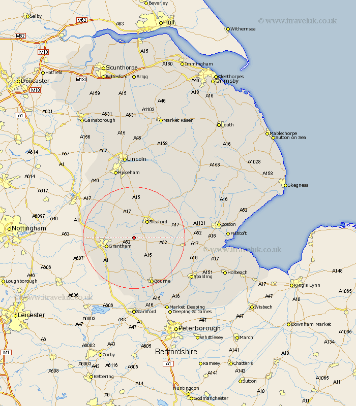
Lincolnshire Map Showing Location of Haydor
Population: 286
District: South Kesteven
Easting: 501927 Northing: 338433
Latitude: 52.93 Longitude: -0.48
 = Haydor
District: South Kesteven
Easting: 501927 Northing: 338433
Latitude: 52.93 Longitude: -0.48
= Haydor
This Haydor map below is supplied by Google. Use the tools in the top left corner to zoom into street level or zoom out for a road map, you may also need to zoom in to see Haydor on the map. Click and drag the map to move around. If the map fails to load try and refresh your browser or zoom in or out (+ or -).
Update - it seems Google no longer allow people to use their maps for free! This Haydor map sometimes loads and sometimes gives a error. I am working on a solution.
Closest 30 Towns or Cities to Haydor (Population over 500)
Ancaster 5km Ropsley 5.99km Belton 7.82km Sleaford 8.29km Folkingham 9.28km Leasingham 10.29km Heasingham 10.29km Grantham 10.72km Cranwell 11.18km Billingborough 11.49km Caythorpe 12.13km Helpringham 12.29km Great Gonerby 12.43km Fulbeck 12.98km Ruskington 12.98km Buskington 12.98km Brauncewell 13.4km Great Hale 13.53km Hale 13.53km Pointon 13.68km Heckington 13.9km Barrowby 13.91km Corby 14.99km Rippingale 15.15km Harlaxton 15.32km Welbourn 15.49km Allington 15.64km Bloxholm 17.27km Bloxholme 17.27km Colsterworth 17.31km