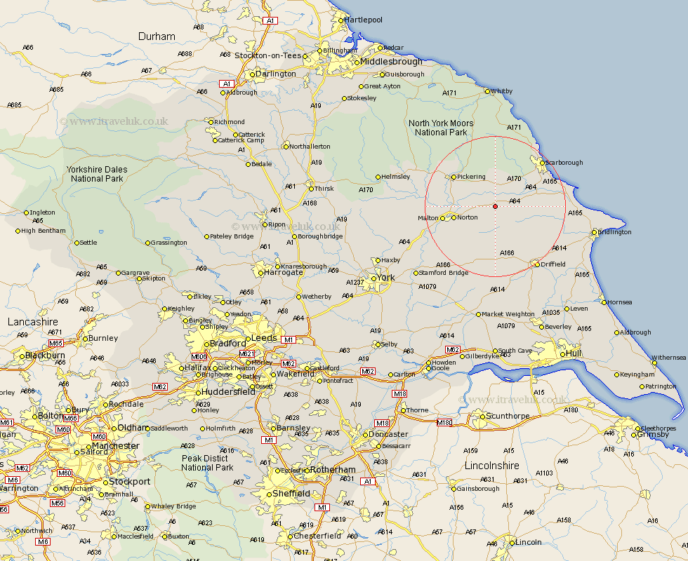
Yorkshire Map Showing Location of Heslerton
Population: 409
District: Ryedale
Easting: 491390 Northing: 475468
Latitude: 54.17 Longitude: -0.6
 = Heslerton
District: Ryedale
Easting: 491390 Northing: 475468
Latitude: 54.17 Longitude: -0.6
= Heslerton
This Heslerton map below is supplied by Google. Use the tools in the top left corner to zoom into street level or zoom out for a road map, you may also need to zoom in to see Heslerton on the map. Click and drag the map to move around. If the map fails to load try and refresh your browser or zoom in or out (+ or -).
Update - it seems Google no longer allow people to use their maps for free! This Heslerton map sometimes loads and sometimes gives a error. I am working on a solution.
Closest 30 Towns or Cities to Heslerton (Population over 500)
Yedingham 3.86km Sherburn 5.43km Snainton 5.66km Brompton 6.44km Rillington 6.77km Willerby 9.94km Thornton Dale 10.6km Thornton-le-Dale 10.6km Norton 11.35km Seamer 13.13km Great Driffield 13.15km Malton 14.17km Pickering 14.26km Eastfield 14.97km Cayton 16.89km Scalby 16.9km Scarborough 18.04km Hunmanby 18.44km Wetwang 18.66km Burniston 19.89km Kilham 19.99km Slingsby 20.7km Filey 20.79km Driffield 20.85km Cloughton 21.46km Nafferton 21.86km North Frodingham 23.51km Kirkby Moorside 24.36km Kirby Moorside 24.36km Terrington 24.52km