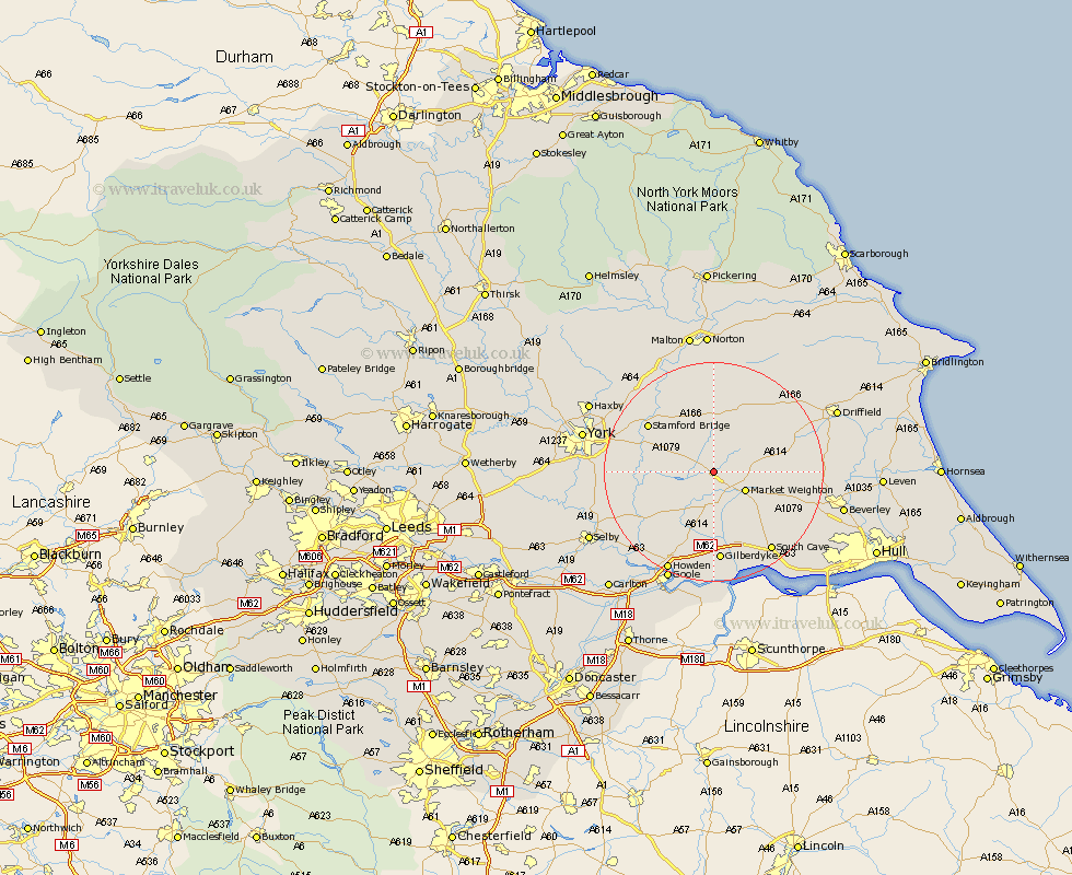
Yorkshire Map Showing Location of Hayton
Population: 317
Easting: 482123 Northing: 445616
Latitude: 53.9 Longitude: -0.75
 = Hayton
Easting: 482123 Northing: 445616
Latitude: 53.9 Longitude: -0.75
= Hayton
This Hayton map below is supplied by Google. Use the tools in the top left corner to zoom into street level or zoom out for a road map, you may also need to zoom in to see Hayton on the map. Click and drag the map to move around. If the map fails to load try and refresh your browser or zoom in or out (+ or -).
Update - it seems Google no longer allow people to use their maps for free! This Hayton map sometimes loads and sometimes gives a error. I am working on a solution.
Closest 30 Towns or Cities to Hayton (Population over 500)
Pocklington 3.7km Barmby 5.72km Barmby-on-the-Moor 5.72km Barmby on the Moor 5.72km Market Weighton 6.6km Melbourne 6.81km Seaton Ross 7.07km Holme 7.5km Holme upon Spalding Moor 7.5km Fangfoss 9.21km Wilberfoss 10.35km Sutton upon Derwent 11.07km Sutton 11.07km Stamford Bridge 14.31km Wheldrake 14.32km Bubwith 14.33km North Cave 16.21km Wetwang 16.36km Cherry Burton 16.8km Eastrington 16.82km Lockington 17.47km South Cave 17.79km Bishop Burton 17.99km Newport 18.35km North Frodingham 18.97km Heslington 19.37km Escrick 19.75km Leckonfield 20.01km Leconfield 20.01km Howden 20.06km