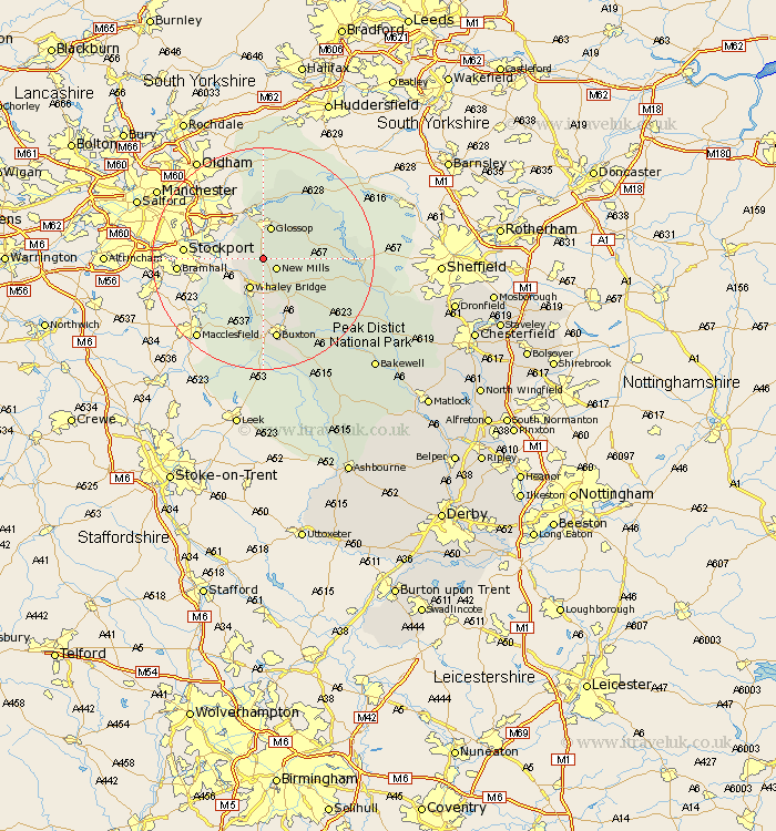
Derbyshire Map Showing Location of Hayfield
Population: 2270
Area Size (ha): 45
District: High Peak
Easting: 403325 Northing: 387414
Latitude: 53.38 Longitude: -1.95
 = Hayfield
Area Size (ha): 45
District: High Peak
Easting: 403325 Northing: 387414
Latitude: 53.38 Longitude: -1.95
= Hayfield
This Hayfield map below is supplied by Google. Use the tools in the top left corner to zoom into street level or zoom out for a road map, you may also need to zoom in to see Hayfield on the map. Click and drag the map to move around. If the map fails to load try and refresh your browser or zoom in or out (+ or -).
Update - it seems Google no longer allow people to use their maps for free! This Hayfield map sometimes loads and sometimes gives a error. I am working on a solution.
Closest 30 Towns or Cities to Hayfield (Population over 500)
New Mills 2.88km Whaley Bridge 5.98km Glossop 6.08km Charlesworth 6.47km Chapel en le Frith 8.12km Tintwhistle 9.34km Tintwistle 9.34km Castleton 13.37km Hope 13.78km Buxton 14.99km Bradwell 15.2km Tideswell 17.79km Bamford 18.08km Hathersage 21.25km Eyam 21.85km Longstone 23.54km Great Longstone 23.54km Stony Middleton 23.77km Stoney Middleton 23.77km Grindleford Bridge 23.79km Grindleford 23.79km Baslow 27.73km Bakewell 27.75km Middleton 28.65km Youlgreave 29.27km Holmesfield 30.85km Dronfield 33.4km Darley Dale 33.49km Barlow 33.6km Winster 34.22km