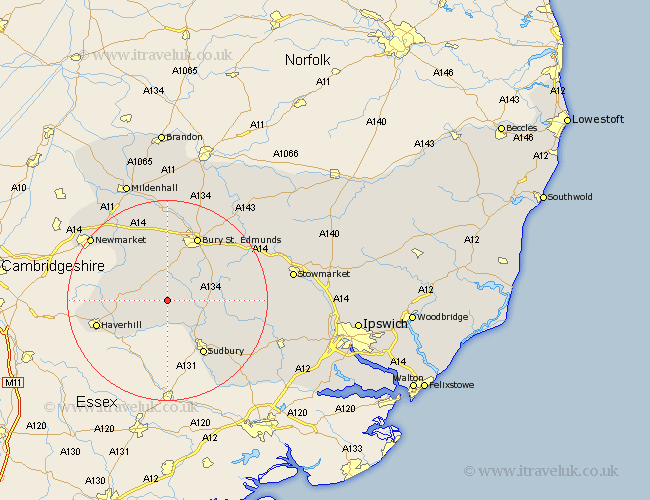
Suffolk Map Showing Location of Hawkedon
Population: 116
District: St. Edmundsbury
Easting: 580209 Northing: 251648
Latitude: 52.13 Longitude: 0.63
 = Hawkedon
District: St. Edmundsbury
Easting: 580209 Northing: 251648
Latitude: 52.13 Longitude: 0.63
= Hawkedon
This Hawkedon map below is supplied by Google. Use the tools in the top left corner to zoom into street level or zoom out for a road map, you may also need to zoom in to see Hawkedon on the map. Click and drag the map to move around. If the map fails to load try and refresh your browser or zoom in or out (+ or -).
Update - it seems Google no longer allow people to use their maps for free! This Hawkedon map sometimes loads and sometimes gives a error. I am working on a solution.
Closest 30 Towns or Cities to Hawkedon (Population over 500)
Glemsford 4.35km Wickhambrook 4.91km Cavendish 5.56km Chedburgh 5.68km Clare 6.52km Hundon 6.79km Lawshall 7.07km Chevington 7.5km Long Melford 9.34km Cockfield 10.4km Barrow 11.63km Kedington 11.65km Lavenham 11.97km Great Waldingfield 12.64km Waldingfield 12.64km Rushbrooke 12.99km Sudbury 13.05km Bradfield St George 13.57km Bradfield 13.57km Bradfield Saint George 13.57km Bradfield St. George 13.57km Bury St. Edmunds 14.17km Bury Saint Edmunds 14.17km Bury St Edmunds 14.17km Great Cornard 14.37km Haverhill 14.75km Risby 14.83km Thurlow 14.91km Gazeley 15.22km Fornham All Saints 15.51km