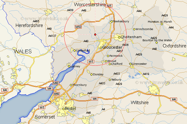
Gloucestershire Map Showing Location of Hartpury
Population: 1298
District: Forest of Dean
Easting: 379368 Northing: 224332
Latitude: 51.92 Longitude: -2.3
 = Hartpury
District: Forest of Dean
Easting: 379368 Northing: 224332
Latitude: 51.92 Longitude: -2.3
= Hartpury
This Hartpury map below is supplied by Google. Use the tools in the top left corner to zoom into street level or zoom out for a road map, you may also need to zoom in to see Hartpury on the map. Click and drag the map to move around. If the map fails to load try and refresh your browser or zoom in or out (+ or -).
Update - it seems Google no longer allow people to use their maps for free! This Hartpury map sometimes loads and sometimes gives a error. I am working on a solution.
Closest 30 Towns or Cities to Hartpury (Population over 500)
Corse 1.85km Ashleworth 2.94km Tibberton 3.9km Newent 7.1km Innsworth 7.8km Redmarley D'Abitot 8.16km Deerhurst 8.83km Huntley 8.83km Staverton 9.14km Churchdown 9.87km Gloucester 9.89km Hucclecote 10.92km Hardwicke 11.12km Quedgeley 11.18km Longhope 11.7km Dymock 11.76km Brockworth 11.78km Shurdington 13.75km Mitcheldean 13.76km Milcheldean 13.76km Tewkesbury 13.84km Swindon 13.84km Cheltenham 14.98km Drybrook 15.6km Ashchurch 15.61km Leckhampton 15.87km Newnham 15.88km Newham 15.88km Bishops Cleeve 16.42km Cinderford 16.8km