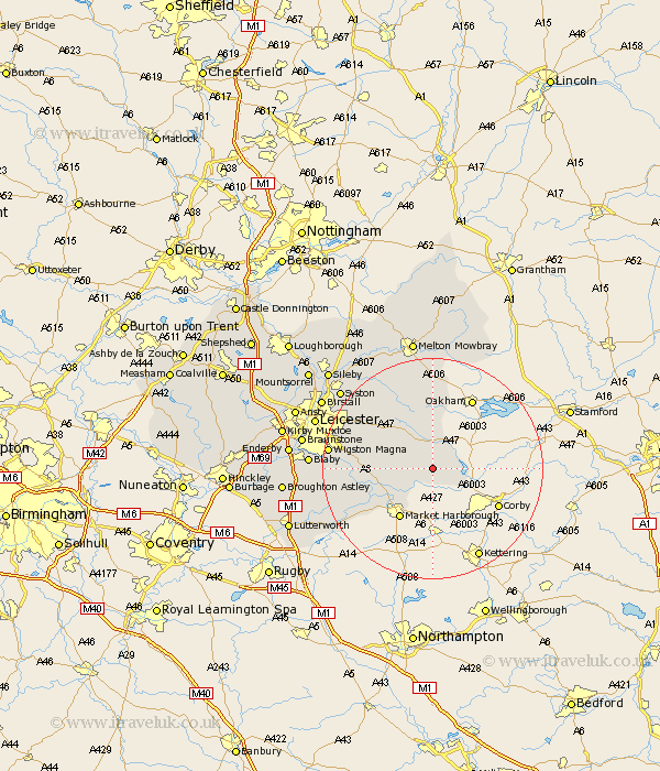
Leicestershire Map Showing Location of Hallaton
Population: 523
District: Harborough
Easting: 479098 Northing: 295363
Latitude: 52.55 Longitude: -0.83
 = Hallaton
District: Harborough
Easting: 479098 Northing: 295363
Latitude: 52.55 Longitude: -0.83
= Hallaton
This Hallaton map below is supplied by Google. Use the tools in the top left corner to zoom into street level or zoom out for a road map, you may also need to zoom in to see Hallaton on the map. Click and drag the map to move around. If the map fails to load try and refresh your browser or zoom in or out (+ or -).
Update - it seems Google no longer allow people to use their maps for free! This Hallaton map sometimes loads and sometimes gives a error. I am working on a solution.
Closest 30 Towns or Cities to Hallaton (Population over 500)
Great Easton 6.74km Great Bowden 8.68km Bowden 8.68km Billesdon 8.75km Kibworth Harcourt 10.31km Kibworth 10.31km Market Harborough 10.85km Lubenham 12.17km Houghton 12.56km Houghton-on-the-Hill 12.56km Houghton on the Hill 12.56km Somerby 12.98km Great Glen 13.65km Twyford 14.14km Oadby 17.3km Wigston 18.4km Wigston Magna 18.4km Husbands Bosworth 18.41km Gaddesby 18.95km Glen Parka 19.24km Glen Parva 19.24km Queniboro 20.05km Queniborough 20.05km Countesthorpe 20.28km Walton 21.3km Walton-in-Knaptoft 21.3km Blaby 21.49km Syston 21.63km Frisby on the Wreak 22.28km Frisby-on-the-Wreak 22.28km