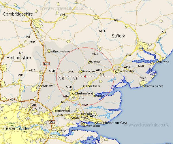
Essex Map Showing Location of Cressing
Population: 1538
District: Braintree
Easting: 579055 Northing: 220067
Latitude: 51.85 Longitude: 0.6
 = Cressing
District: Braintree
Easting: 579055 Northing: 220067
Latitude: 51.85 Longitude: 0.6
= Cressing
This Cressing map below is supplied by Google. Use the tools in the top left corner to zoom into street level or zoom out for a road map, you may also need to zoom in to see Cressing on the map. Click and drag the map to move around. If the map fails to load try and refresh your browser or zoom in or out (+ or -).
Update - it seems Google no longer allow people to use their maps for free! This Cressing map sometimes loads and sometimes gives a error. I am working on a solution.
Closest 30 Towns or Cities to Cressing (Population over 500)
Rayne 2.18km Bradwell 2.18km Black Notley 3.43km Stisted 3.88km Braintree 4.35km Rivenhall 4.94km Coggeshall 6.02km Terling 6.54km Panfield 6.82km Great Leighs 6.82km Kelvedon 7.12km Hatfield Peverel 7.42km Witham 7.76km Feering 8.01km Wickham Bishops 8.72km Great Totham 8.84km Totham 8.84km Gosfield 9.33km Little Waltham 9.76km Boreham 9.88km Tiptree 10.72km Halstead 11.35km Earls Colne 11.53km Shalford 11.53km Great Tey 11.7km Great Bardfield 12.24km Wakes Colne 12.69km Great Waltham 12.7km Marks Tey 12.73km Sible Hedingham 13.02km