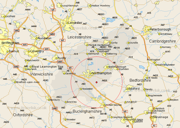
Northamptonshire Map Showing Location of Hackleton
Population: 2045
District: South Northamptonshire
Easting: 480895 Northing: 254599
Latitude: 52.18 Longitude: -0.82
 = Hackleton
District: South Northamptonshire
Easting: 480895 Northing: 254599
Latitude: 52.18 Longitude: -0.82
= Hackleton
This Hackleton map below is supplied by Google. Use the tools in the top left corner to zoom into street level or zoom out for a road map, you may also need to zoom in to see Hackleton on the map. Click and drag the map to move around. If the map fails to load try and refresh your browser or zoom in or out (+ or -).
Update - it seems Google no longer allow people to use their maps for free! This Hackleton map sometimes loads and sometimes gives a error. I am working on a solution.
Closest 30 Towns or Cities to Hackleton (Population over 500)
Denton 3.88km Great Houghton 3.88km Houghton 3.88km Wootton 4.55km Hardingstone 4.91km Collingtree 5.68km Roade 5.86km Yardley Hastings 5.98km Hartwell 6.01km Milton 6.82km Whiston 7.18km Billing 7.42km Great Billing 7.42km Blisworth 8.17km Earls Barton 8.7km Northampton 8.7km Gayton 10.39km Bozeat 10.88km Kislingbury 10.88km Overstone 11.12km Moulton 11.35km Sywell 11.35km Wilby 11.51km Great Doddington 12.21km Doddington 12.21km Boughton 12.48km Wollaston 12.63km Harpole 12.65km Towcester 12.66km Paulerspury 13.68km