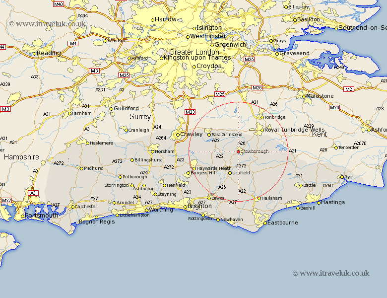
Sussex Map Showing Location of Crowborough
Population: 19077
Area Size (ha): 680
District: Wealden
Easting: 550680 Northing: 130108
Latitude: 51.05 Longitude: 0.15
 = Crowborough
Area Size (ha): 680
District: Wealden
Easting: 550680 Northing: 130108
Latitude: 51.05 Longitude: 0.15
= Crowborough
This Crowborough map below is supplied by Google. Use the tools in the top left corner to zoom into street level or zoom out for a road map, you may also need to zoom in to see Crowborough on the map. Click and drag the map to move around. If the map fails to load try and refresh your browser or zoom in or out (+ or -).
Update - it seems Google no longer allow people to use their maps for free! This Crowborough map sometimes loads and sometimes gives a error. I am working on a solution.
Closest 30 Towns or Cities to Crowborough (Population over 500)
Withyham 3.88km Hartfield 4.38km Rotherfield 5.02km Buxted 7.51km Hadlow Down 7.77km Maresfield 8.76km Mayfield 8.93km Frant 8.95km Uckfield 9.9km Fletching 11.03km Framfield 11.18km Horsted Keynes 12.23km Wadhurst 12.82km Newick 13.15km Forest Row 13.33km Heathfield 13.79km East Grinstead 13.8km Isfield 14.23km Chailey 14.51km East Hoathly 14.87km Warbleton 15.98km Lindfield 16.14km Horam 16.39km Horeham 16.39km Ardingly 16.42km Turners Hill 16.72km Chiddingly 16.84km Burwash 17.24km Barcombe Mills Station 18.57km Laughton 18.57km