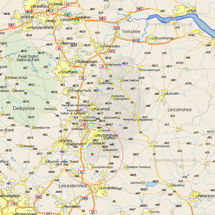
Nottinghamshire Map Showing Location of Gotham
Population: 1598
Area Size (ha): 56
District: Rushcliffe
Easting: 453868 Northing: 328391
Latitude: 52.85 Longitude: -1.2
 = Gotham
Area Size (ha): 56
District: Rushcliffe
Easting: 453868 Northing: 328391
Latitude: 52.85 Longitude: -1.2
= Gotham
This Gotham map below is supplied by Google. Use the tools in the top left corner to zoom into street level or zoom out for a road map, you may also need to zoom in to see Gotham on the map. Click and drag the map to move around. If the map fails to load try and refresh your browser or zoom in or out (+ or -).
Update - it seems Google no longer allow people to use their maps for free! This Gotham map sometimes loads and sometimes gives a error. I am working on a solution.
Closest 30 Towns or Cities to Gotham (Population over 500)
Gotham 0km Sutton Bonington 3.84km East Leake 4.33km Bunny 4.48km Ruddington 5km Costock 5.81km Beeston 7.5km Stapleford 8.66km West Bridgford 9.29km West Bridgeford 9.29km Tollerton 10.78km Trowell 10.82km Cotgrave 12.49km Nottingham 13.17km Nottigham 13.17km Colwick 13.6km Carlton 13.6km Cossall 14.13km Radcliffe-on-Trent 14.52km Radcliffe 14.52km Radcliffe on Trent 14.52km Kinoulton 14.55km Kimberley 15.48km Cropwell Bishop 15.57km Awsworth 15.84km Cropwell Butler 16.32km Cropwell 16.32km Arnold 17.27km Lambley 17.31km Shelford 17.88km