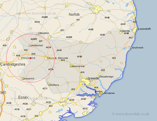
Suffolk Map Showing Location of Gazeley
Population: 692
District: Forest Heath
Easting: 571776 Northing: 264341
Latitude: 52.25 Longitude: 0.52
 = Gazeley
District: Forest Heath
Easting: 571776 Northing: 264341
Latitude: 52.25 Longitude: 0.52
= Gazeley
This Gazeley map below is supplied by Google. Use the tools in the top left corner to zoom into street level or zoom out for a road map, you may also need to zoom in to see Gazeley on the map. Click and drag the map to move around. If the map fails to load try and refresh your browser or zoom in or out (+ or -).
Update - it seems Google no longer allow people to use their maps for free! This Gazeley map sometimes loads and sometimes gives a error. I am working on a solution.
Closest 30 Towns or Cities to Gazeley (Population over 500)
Moulton 2.27km Barrow 4.9km Newmarket 6.81km Risby 8.15km Chevington 8.79km Chedburgh 10.07km Mildenhall 11.12km Exning 11.5km Wickhambrook 11.63km Fornham All Saints 12.62km Eriswell 13.03km Bury Saint Edmunds 13.61km Bury St. Edmunds 13.61km Bury St Edmunds 13.61km Thurlow 16.32km Hundon 16.83km Great Barton 17.12km Rushbrooke 17.42km Lawshall 18.48km Kedington 18.67km Clare 19.09km Haverhill 19.39km Glemsford 19.57km Troston 19.6km Barnham 19.63km Bradfield St. George 20.08km Bradfield St George 20.08km Bradfield Saint George 20.08km Bradfield 20.08km Cavendish 20.17km