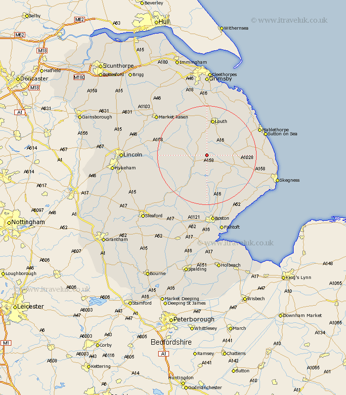
Lincolnshire Map Showing Location of Fulletby
Population: 78
District: East Lindsey
Easting: 530139 Northing: 372501
Latitude: 53.23 Longitude: -0.05
 = Fulletby
District: East Lindsey
Easting: 530139 Northing: 372501
Latitude: 53.23 Longitude: -0.05
= Fulletby
This Fulletby map below is supplied by Google. Use the tools in the top left corner to zoom into street level or zoom out for a road map, you may also need to zoom in to see Fulletby on the map. Click and drag the map to move around. If the map fails to load try and refresh your browser or zoom in or out (+ or -).
Update - it seems Google no longer allow people to use their maps for free! This Fulletby map sometimes loads and sometimes gives a error. I am working on a solution.
Closest 30 Towns or Cities to Fulletby (Population over 500)
Mareham on the Hill 5.67km Mareham-on-the-Hill 5.67km Mareham 5.67km Horncastle 5.78km Banovallum 5.78km Spilsby 11.43km Legbourne 12.95km Woodhall Spa 14.46km Louth 15km Coningsby 15.12km Alford 15.64km Carrington 16.68km Willoughby 16.74km Stickney 17.26km Grimoldby 17.28km Wragby 17.53km Bardney 17.85km Manby 17.87km Tattershall 17.88km Holton 20.25km Huttoft 21.15km Burgh le Marsh 22.03km Frithville 22.27km Sibsey 22.68km Billinghay 22.81km Mablethorpe 22.83km Croft 22.87km Martin 22.91km binbrook 23.94km Sutton on Sea 24.03km