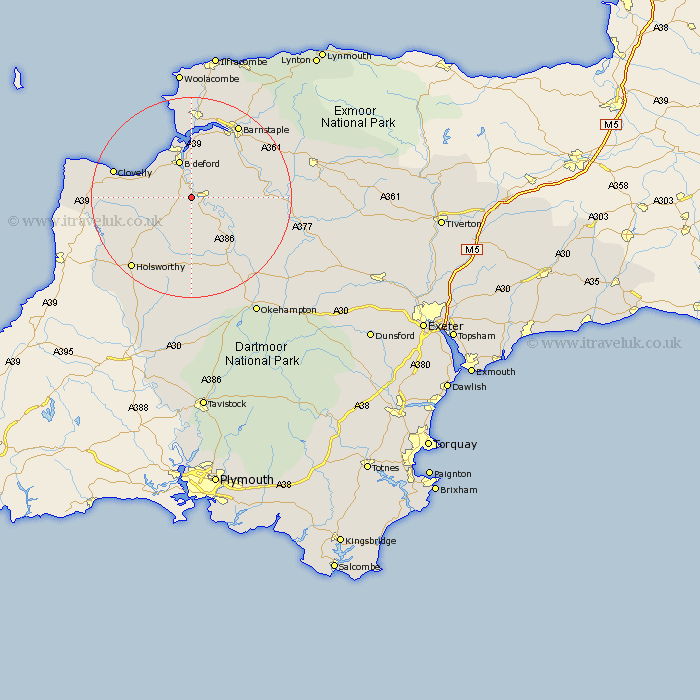
Devon Map Showing Location of Frithelstock
Population: 366
District: Torridge
Easting: 246654 Northing: 119059
Latitude: 50.95 Longitude: -4.18
 = Frithelstock
District: Torridge
Easting: 246654 Northing: 119059
Latitude: 50.95 Longitude: -4.18
= Frithelstock
This Frithelstock map below is supplied by Google. Use the tools in the top left corner to zoom into street level or zoom out for a road map, you may also need to zoom in to see Frithelstock on the map. Click and drag the map to move around. If the map fails to load try and refresh your browser or zoom in or out (+ or -).
Update - it seems Google no longer allow people to use their maps for free! This Frithelstock map sometimes loads and sometimes gives a error. I am working on a solution.
Closest 30 Towns or Cities to Frithelstock (Population over 500)
Torrington 2.34km Great Torrington 2.34km Langtree 3.88km Buckland Brewer 5.03km Bideford 7.77km Parkham 8.38km Northam 9.56km Appledore 11.18km Instow 11.18km Shebbear 11.36km Dolton 12.87km High Bickington 12.97km Fremington 13.79km Woolsery 14.13km Woolfardisworthy 14.13km Tawstock 14.52km Black Torrington 14.82km Bradworthy 15.08km Barrington 16.45km Burrington 16.45km Braunton 16.68km Hatherleigh 16.93km Barnstaple 17.52km Chittlehampton 17.94km Swimbridge 18.8km Holsworthy 18.88km Marwood 19.81km Georgeham 20.42km Halwill 20.68km Northlew 20.91km