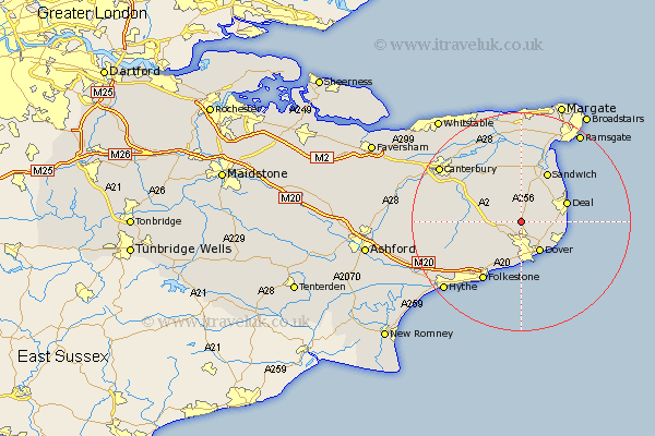
Kent Map Showing Location of Eythorne
Population: 1474
Area Size (ha): 47
District: Dover
Easting: 629432 Northing: 147856
Latitude: 51.18 Longitude: 1.28
 = Eythorne
Area Size (ha): 47
District: Dover
Easting: 629432 Northing: 147856
Latitude: 51.18 Longitude: 1.28
= Eythorne
This Eythorne map below is supplied by Google. Use the tools in the top left corner to zoom into street level or zoom out for a road map, you may also need to zoom in to see Eythorne on the map. Click and drag the map to move around. If the map fails to load try and refresh your browser or zoom in or out (+ or -).
Update - it seems Google no longer allow people to use their maps for free! This Eythorne map sometimes loads and sometimes gives a error. I am working on a solution.
Closest 30 Towns or Cities to Eythorne (Population over 500)
Langdon 2.97km West Langdon 2.97km Coldred 2.97km Shepherdswell 3.48km Sibertswold 3.48km Ewell 3.88km Temple Ewell 3.88km Lydden 4.37km St. Margarets 4.37km Saint Margarets 4.37km St Margaret at Cliffe 4.37km Saint Margaret at Cliffe 4.37km St Margarets 4.37km Saint Margaret's at Cliffe 4.37km St. Margaret at Cliffe 4.37km St. Margaret's at Cliffe 4.37km St Margaret's at Cliffe 4.37km Northbourne 5.09km Eastry 5.68km River 5.68km Mongeham 6.1km Great Mongeham 6.1km Dover 6.44km Alkham 6.56km Staple 7.77km Sholden 7.9km Kingsdown 8.13km Walmer 8.34km Worth 8.75km Swingfield 8.92km