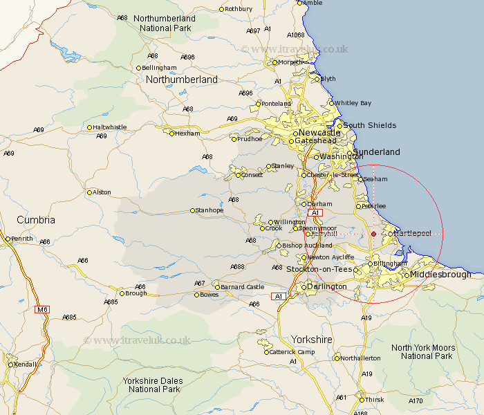
Durham Map Showing Location of Elwick
Population: 696
Easting: 446199 Northing: 532275
Latitude: 54.68 Longitude: -1.28
 = Elwick
Easting: 446199 Northing: 532275
Latitude: 54.68 Longitude: -1.28
= Elwick
This Elwick map below is supplied by Google. Use the tools in the top left corner to zoom into street level or zoom out for a road map, you may also need to zoom in to see Elwick on the map. Click and drag the map to move around. If the map fails to load try and refresh your browser or zoom in or out (+ or -).
Update - it seems Google no longer allow people to use their maps for free! This Elwick map sometimes loads and sometimes gives a error. I am working on a solution.
Closest 30 Towns or Cities to Elwick (Population over 500)
Hart 3.86km Hartlepool 4.29km Hutton Henry 5.67km Greatham 6.42km Wolviston 7.41km Horden 7.42km Hesleden 7.72km Wingate 8.5km Trimdon 8.77km Billingham on Tees 9.32km Billingham 9.32km Billingham-on-Tees 9.32km Fishburn 9.64km Peterlee 9.69km Grindon 9.81km Sedgefield 10.33km Stockton 12.08km Stockton-on-Tees 12.08km Stockton on Tees 12.08km Thornley 12.16km Shotton 12.34km Easington 12.34km Bishop Middleham 12.86km Stillington 13.38km Carlton 13.42km Haswell 14.03km Coxhoe 14.41km South Hetton 14.98km West Cornforth 15.11km Cornforth 15.11km