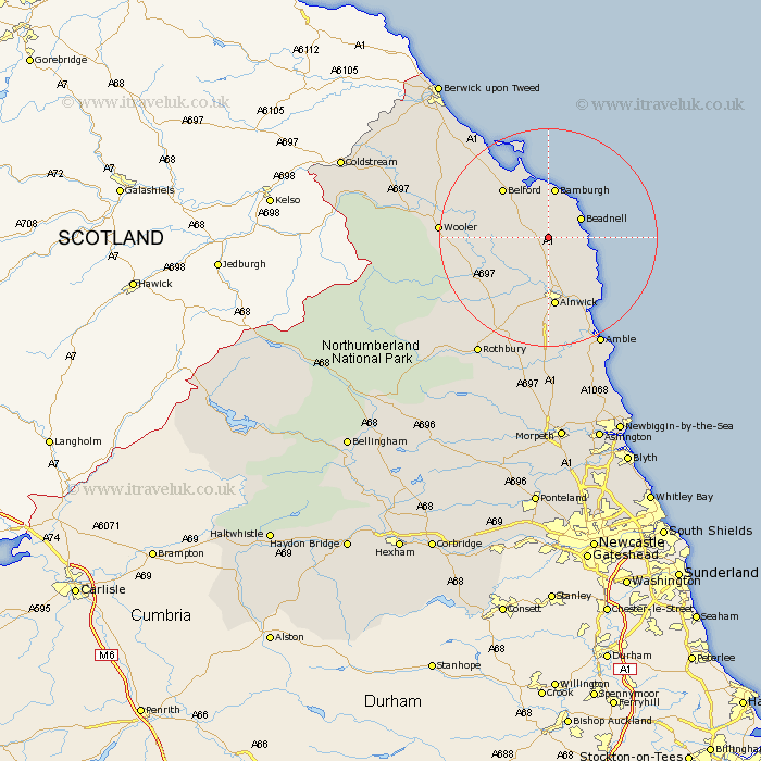
Northumberland Map Showing Location of Ellingham
Population: 282
District: Berwick-upon-Tweed
Easting: 417888 Northing: 624809
Latitude: 55.52 Longitude: -1.72
 = Ellingham
District: Berwick-upon-Tweed
Easting: 417888 Northing: 624809
Latitude: 55.52 Longitude: -1.72
= Ellingham
This Ellingham map below is supplied by Google. Use the tools in the top left corner to zoom into street level or zoom out for a road map, you may also need to zoom in to see Ellingham on the map. Click and drag the map to move around. If the map fails to load try and refresh your browser or zoom in or out (+ or -).
Update - it seems Google no longer allow people to use their maps for free! This Ellingham map sometimes loads and sometimes gives a error. I am working on a solution.
Closest 30 Towns or Cities to Ellingham (Population over 500)
North Sunderland 6.39km Beadnell 6.42km Embleton 7.31km Belford 11.82km Alnwick 13.02km Almwick 13.02km Alnmouth 14.92km Lesbury 16.12km Lisburg 16.12km Shilbottle 16.81km Wooler 17.93km Warkworth 19.58km Lowick 20.37km Amble 22.06km Swarland 24.12km Rothbury 25.07km Felton 25.97km Thirston 26.04km East Thirston 26.04km Longframlington 26.29km Ancroft 27.06km East Chevington 27.28km Longhorsley 31.67km East Ord 32.06km Ord 32.06km Berwick-Upon-Tweed 34.57km Berwick on Tweed 34.57km Berwick 34.57km Berwick-upon-Tweed 34.57km Berwick-on-Tweed 34.57km